Remote Sensing of Global Croplands for Food Security Remote Sensing Applications Series
Coordonnateurs : Thenkabail Prasad, Lyon John G., Turral Hugh, Biradar Chandrashekhar
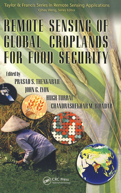
Increases in populations have created an increasing demand for food crops while increases in demand for biofuels have created an increase in demand for fuel crops. What has not increased is the amount of croplands and their productivity. These and many other factors such as decreasing water resources in a changing climate have created a crisis like situation in global food security. Decision makers in these situations need accurate information based on science. Remote Sensing of Global Croplands for Food Security provides a comprehensive knowledge base in use of satellite sensor-based maps and statistics that can be used to develop strategies for croplands (irrigated and rainfed) and their water use for food security.
Over 50 Multi-disciplinary Global Experts Give Insight and Provide Practical Approaches
Emphasizing practical mapping technologies based on advanced remote sensing data and methods, this book provides approaches for estimating irrigated and rainfed cropland areas and their water use on a national, continental, or global basis. Written by 50+ leading experts working at the forefront of this critical area, it offers case studies from a variety of continents highlighting the subtle requirements of each. In a very practical way it demonstrates the experience, utility, and models for determining water resources used and resulting yields of irrigated and rainfed croplands. The authors discuss: (a) innovative methods used for mapping croplands, (b) approaches adopted to collect cropland data in different countries by traditional and non-traditional means, (c) accuracies, uncertainties, and errors involved in producing cropland products, (d) surface energy balance models used to assess crop water use, and (e) extensive results and outcomes pertaining to global croplands and their water use.
Develop Strategies for an Enhanced Green Revolution and an Accelerated Blue Revolution
Linking croplands to water use and food security, the book provides a global perspective on this sensitive issue. It gives insight into the extent of cropland usage, their spatial distribution, their cropping intensities, and their water use patterns. The editors collect the experience, methods, models, and results that show the way forward and help in decision-making on water resources and food security. All of this is required for developing strategies for an enhanced green revolution and for an accelerated blue revolution.
Background and History of Global Irrigated Area Maps (GIAM). Global Irrigated Area Mapping (GIAM) Using Remote Sensing. GIAM Mapping Section for Selected Global Regions. Evapotranspiration Models, Water Use, and Irrigated Areas. Rain-Fed Cropland Areas of the World. Methods of Mapping Croplands Using Remote Sensing. Accuracies and Errors. Way Forward in Mapping Global Irrigated and Rain-Fed Croplands.
Date de parution : 06-2009
15.6x23.4 cm
Date de parution : 11-2018
15.6x23.4 cm
Disponible chez l'éditeur (délai d'approvisionnement : 14 jours).
Prix indicatif 87,11 €
Ajouter au panierThèmes de Remote Sensing of Global Croplands for Food Security :
Mots-clés :
Irrigated Areas; Mapping Irrigated Area; global irrigated area mapping; Rechna Doab; remote sensing; Data Set; rain-fed cropland; accuracy and error analysis; Pe Rc; evapotranspiration models; MODIS Data; Land Cover; Da Ta; Data; Spot Vegetation; Fallow Cropland; United Nations Joint Logistics Centre; NDVI Cycle; Groundtruth Data; NBS Data; Energy Balance; Cropland Mapping; Land Cover Type; National Agricultural Statistics Service; Spot VGT; Land Cover Class; USGS; FAO Data; Cropland Areas