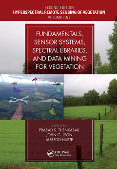
Fundamentals, Sensor Systems, Spectral Libraries, and Data Mining for Vegetation (2nd Ed.) Hyperspectral Remote Sensing of Vegetation Hyperspectral Remote Sensing of Vegetation, Second Edition Series
Coordonnateurs : Thenkabail Prasad S., Lyon John G., Huete Alfredo
Written by leading global experts, including pioneers in the field, the four-volume set on Hyperspectral Remote Sensing of Vegetation, Second Edition, reviews existing state-of-the-art knowledge, highlights advances made in different areas, and provides guidance for the appropriate use of hyperspectral data in the study and management of agricultural crops and natural vegetation.
Volume I, Fundamentals, Sensor Systems, Spectral Libraries, and Data Mining for Vegetation introduces the fundamentals of hyperspectral or imaging spectroscopy data, including hyperspectral data processes, sensor systems, spectral libraries, and data mining and analysis, covering both the strengths and limitations of these topics. This book also presents and discusses hyperspectral narrowband data acquired in numerous unique spectral bands in the entire length of the spectrum from various ground-based, airborne, and spaceborne platforms. The concluding chapter provides readers with useful guidance on the highlights and essence of Volume I through the editors? perspective.
Key Features of Volume I:
- Provides the fundamentals of hyperspectral remote sensing used in agricultural crops and vegetation studies.
- Discusses the latest advances in hyperspectral remote sensing of ecosystems and croplands.
- Develops online hyperspectral libraries, proximal sensing and phenotyping for understanding, modeling, mapping, and monitoring crop and vegetation traits.
- Implements reflectance spectroscopy of soils and vegetation.
- Enumerates hyperspectral data mining and data processing methods, approaches, and machine learning algorithms.
- Explores methods and approaches for data mining and overcoming data redundancy;
- Highlights the advanced methods for hyperspectral data processing steps by developing or implementing appropriate algorithms and coding the same for processing on a cloud computing platform like the Google Earth Engine.
- Integrates hyperspectral with other data, such as the LiDAR data, in the study of vegetation.
- Includes best global expertise on hyperspectral remote sensing of agriculture, crop water use, plant species detection, crop productivity and water productivity mapping, and modeling.
Section I: Introduction to Hyperspectral Remote Sensing of Agricultural Crops and Vegetation 1. Advances in Hyperspectral Remote Sensing of Vegetation and Agricultural Crops Section II: Hyperspectral Sensor Systems 2. Hyperspectral Sensor Characteristics: Airborne, Spaceborne, Hand-Held, and Truck-Mounted; Integration of Hyperspectral Data with LiDAR 3. Hyperspectral Remote Sensing in Global Change Studies Section III: Hyperspectral Libraries of Agricultural Crops and Vegetation 4. Monitoring Vegetation Diversity and Health through Spectral Traits and Trait Variations Based on Hyperspectral Remote Sensing 5. The Use of Hyperspectral Proximal Sensing for Phenotyping of Plant Breeding Trials 6. Linking Online Spectral Libraries with Hyperspectral Test Data through Library Building Tools and Code 7. The Use of Spectral Databases for Remote Sensing of Agricultural Crops 8. Characterization of Soil Properties Using Reflectance Spectroscopy Section IV: Hyperspectral Data Mining, Data Fusion, and Algorithms 9. Spaceborne Hyperspectral EO-1 Hyperion Data Pre-Processing: Methods, Approaches, and Algorithms 10. Hyperspectral Image Data Mining 11. Hyperspectral Data Processing Algorithms 12. Methods for Linking Drone and Field Hyperspectral Data to Satellite Data 13. Integrating Hyperspectral and LiDAR Data in the Study of Vegetation 14. Fifty-Years of Advances in Hyperspectral Remote Sensing of Agriculture and Vegetation—Summary, Insights, and Highlights of Volume I: Fundamentals, Sensor Systems, Spectral Libraries, and Data Mining for Vegetation
Dr. Prasad S. Thenkabail, Research Geographer-15, U.S. Geological Survey (USGS), is a world-recognized expert in remote sensing science with multiple major contributions in the field sustained over more than 30 years. He obtained his PhD from the Ohio State University in 1992 and has over 140+ peer-reviewed scientific publications. Dr. Thenkabail has conducted pioneering cutting-edge research in the area of hyperspectral remote sensing of vegetation (https://www.usgs.gov/wgsc/GHISA/) and in that of global croplands and their water use for food security (www.croplands.org). Dr. Thenkabail’s contributions to series of leading edited books on remote sensing science along with his research and other contributions in the subject places his as a noted global expert in remote sensing science. He edited three-volume book entitled Remote Sensing Handbook published by Taylor and Francis, with 82 chapters and more than 2000 pages, widely considered a "magnus opus" encyclopedic standard reference for students, scholars, practitioners, and major experts in remote sensing science. He has recently completed editing four-volume Hyperspectral Remote Sensing of Vegetation. He has also edited a book on Remote Sensing of Global Croplands for Food Security. He is currently an editor-in-chief of the Remote Sensing open access journal published by MDPI; an associate editor of the journal Photogrammetric Engineering and Remote Sensing (PERS) of the American Society of Photogrammetry and Remote Sensing (ASPRS); and an editorial advisory board member of the International Society of Photogrammetry and Remote Sensing (ISPRS) Journal of Photogrammetry and Remote Sensing. NASA and USGS selected him on the Landsat Science team (2007-2011). Earlier, he served on the editorial board of Remote Sensing of Environment for many years (2007–2017). He has won three best paper awards from ASPRS for his publications in PE&RS.
Date de parution : 01-2023
17.8x25.4 cm
Date de parution : 12-2018
17.8x25.4 cm
Thèmes de Fundamentals, Sensor Systems, Spectral Libraries, and... :
Mots-clés :
Kernel Fisher Discriminant Analysis; Hyperspectral Data; Hyperspectral sensor systems; LiDAR Metric; Spaceborne hyperspectral EO-1 Hyperion pre-processing; Hyperspectral Remote Sensing; Broad-band data from sensors; Landsat ETM+; Hyperspectral Vegetation Indices; UAV and field hyperspectral data; LiDAR Data; Crop water use and water productivity modeling and mapping; Airborne LiDAR; Cloud computing; HSI; hyperspectral narrowband data; Hyperspectral Sensors; agricultural crops management; EO-1 Hyperion; Aster Spectral Library; data mining; Spectral Libraries; natural vegetation management; Pixel Vector; RTM Inversion; LiDAR System; SMA; Hyperspectral Data Analysis; Hyperspectral Narrow Bands; ST; Soil Spectral; Soil Spectroscopy; Vis Region; Redundant Bands; Smile Correction; Ann Model