Remote Sensing (3rd Ed.) Models and Methods for Image Processing
Auteur : Schowengerdt Robert A.
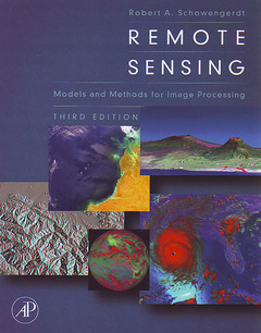
Remote sensing is a technology that engages electromagnetic sensors to measure and monitor changes in the earth?s surface and atmosphere. Normally this is accomplished through the use of a satellite or aircraft. Remote Sensing, in its third edition, seamlessly connects the art and science of earth remote sensing with the latest interpretative tools and techniques of computer-aided image processing. Newly expanded and updated, this edition delivers more of the applied scientific theory and practical results that helped the previous editions earn wide acclaim and become classroom and industry standards.
Dr. Schowengerdt presents an advanced unified framework and rationale that uniquely empowers the reader with the latest critical thinking skills and prerequisite knowledge needed to successfully design, develop and incorporate maintainable remote sensing solutions for real-world application. Advanced remote sensing image processing techniques such as hyperspectral image analysis, fusion of multisensor images and digital elevation model extraction from stereo imagery are discussed theoretically in terms of spectral, spatial, and geometric models. An expanded exercise section is also included at the end of each chapter allowing for the greatest level of mastery ever.
1. The Nature of Remote Sensing 2. Optical Radiation Models 3. Sensor Models 4. Data Models 5. Spectral Transforms 6. Spatial Transforms 7. Correction and Calibration 8. Image Registration and Fusion 9. Thematic Classification
Appendix A. Sensor Acronyms B. Function Definitions
- Features a new lively discussion of the NASA EOS satellites, Terra and Aqua, and the commercial satellites IKONOS and Quickbird
- New larger format provides additional access to 32 PAGE - FULL COLOR plate insert and improved readability
- Additional data processing algorithms help connect and enhance the collective understanding of engineering design and remotely sensed data
Date de parution : 10-2006
Ouvrage de 560 p.
19x23.3 cm