Making Maps, Third Edition (3rd Ed.) A Visual Guide to Map Design for GIS
Auteurs : Krygier John, Wood Denis
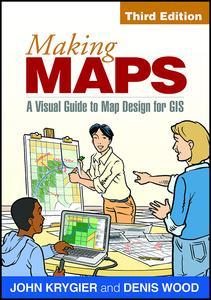
Lauded for its accessibility and beautiful design, this text has given thousands of students and professionals the tools to create effective, compelling maps. Using a wealth of illustrations--with 74 in full color--to elucidate each concisely presented point, the revised and updated third edition continues to emphasize how design choices relate to the reasons for making a map and its intended purpose. All components of map making are covered: titles, labels, legends, visual hierarchy, font selection, how to turn phenomena into visual data, data organization, symbolization, and more. Innovative pedagogical features include a short graphic novella, good design/poor design map examples, end-of-chapter suggestions for further reading, and an annotated map examplar that runs throughout the book.
New to This Edition
*Expanded coverage of using mobile digital devices to collect data for maps, including discussions of location services and locational privacy.
*New and revised topics: how to do sketch maps, how map categories and symbols have changed over time, designing maps on desktop computers and mobile devices, human perception and color, and more.
*Separate, expanded chapter on map symbol abstraction.
*Additional case studies of compelling phenomena such as children's traffic fatalities based on race, the spread of tropical diseases, and the 2012 presidential election.
*Many additional color illustrations.
1. How to Make a Map
2. What's Your Map For?
3. Mappable Data
4. Map Making Tools
5. Geographic Framework
6. The Big Picture of Map Design
7. The Inner Workings of Map Design
8. Map Generalization and Classification
9. Map Symbolization
10. Map Symbol Abstraction
11. Words on Maps
12. Color on Maps
Index
John Krygier, PhD, teaches in the Department of Geology and Geography at Ohio Wesleyan University, with teaching and research specializations in cartography, geographic information systems (GIS), and environmental and human geography. He has made lots of maps and published on map design, educational technology, cultural geography, multimedia in cartography, planning, the history of cartography, and participatory GIS.
Denis Wood, PhD, is an independent scholar living in Raleigh, North Carolina. He lectures widely and is the author of a dozen books and over 150 papers. From 1974 to 1996, he taught in the School of Design at North Carolina State University. In 1992, he curated the Power of Maps exhibition for the Cooper-Hewitt National Museum of Design (remounted at the Smithsonian in Washington, DC, in 1994), for which he wrote the book The Power of Maps. His other books include Rethinking the Power of Maps; Making Maps, Third Edition (coauthored with John Krygier); and Weaponizing Maps (coauthored with Joe Bryan).
Date de parution : 10-2016
17.8x25.4 cm