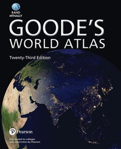
Goode's World Atlas (23rd Ed.)
Auteur : Rand McNally

For all geography courses.
Expand your geographic literacy with the gold standard in academic atlases
Goode?s World Atlas by Rand McNally helps students navigate through global and regional landscapes with ease. With color-coded headings and charts, brief introductions to each section, and more than 60 new reference and thematic maps, the 23rd edition gives you a comprehensive view of the world and its changing population and physical characteristics. Available soon in Pearson eText and Pearson Custom Library formats. Goode?s World Atlas has been the world?s premiere educational atlas since 1923, evolving with the world that shapes its content, and allowing for a deeper, more global understanding of geography.
1. Introduction
2. The World
3. North America
4. South America
5. Europe
6. Asia
7. Africa
8. Australia, New Zealand & Oceania
9. The Oceans & Polar Regions
10. Tables & Indexes
Goode’s Atlas is named for John Paul Goode, who created the atlas and served as its editor for many editions. Goode was one of the first U.S. academic cartographers. He was born in rural Minnesota in 1862, received his bachelor’s degree from the University of Minnesota in 1889, and earned his doctorate in economic geography from the University of Pennsylvania in 1903. He spent much of his professional career at the University of Chicago. Among his many accomplishments he is perhaps best known for the development of the Interrupted Homolosine projection, which he first presented at the Association of American Geographers meeting in 1923, and which has been used extensively in Goode’s Atlas and in many other geographic publications to the present day.
The Homolosine is a composite of two projections, the Mollweide (Homolographic) and the Sinusoidal. Goode interrupted the Homolosine over the oceans to minimize distortion of shapes over continental land masses. Lines of latitude on the Homolosine are straight lines, to facilitate analysis of comparative latitudes. Also, the projection is equal area. Goode was a strong proponent of equal area projections and an equally strong opponent of the Mercator projection, widely used in the early part of the 20th century for world maps. As Goode stated in the introduction to the 1st edition of the atlas (1923, p. x), the distortion of area on the Mercator projection is so extreme that “it becomes pedagogically a crime to use Mercator’s map” for studies of areal distributions such as population density, rainfall, or sizes of countries.
Under Goode’s editorship the atlas doubled in size. The 1st edition of Goode’s School Atlas contained 96 pages of maps. The 4th edition (1932), the last edition that Goode would edit before his death, contained 174 pages
Date de parution : 09-2016
22.4x27.4 cm
Disponible chez l'éditeur (délai d'approvisionnement : 14 jours).
Prix indicatif 57,17 €
Ajouter au panier