Atlas of Antarctica, Softcover reprint of the original 1st ed. 2004 Topographic Maps from Geostatistical Analysis of Satellite Radar Altimeter Data
Langue : Anglais
Auteur : Herzfeld Ute Christina
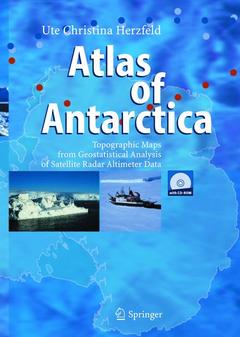
The atlas consists of 136 topographic maps derived from satellite radar altimetry (Geosat and ERS-1 data). Each map is presented together with a description of glaciologic and topographic features. The main section is preceded by an introduction and three up-to-date topics and followed by applications. Applications are in monitoring changes in Antarctic glaciers, ice streams and ice shelves, and in detailed regional studies of outlet glaciers of the inland ice. The reader will also find index maps, an exhaustive list of references on related subjects in glaciology, geodesy, geomathematics, remote sensing, and an index of the Antarctic place names.
(I) Motivation and Methods.- (A) The Antarctic Ice Sheet and its Role in the Global System.- (A.1) Main Geographic and Glaciologic Provinces of Antarctica.- (A.2) Climatic Change, Sea-Level Rise, and Changes in the Cryosphere.- (A.3) Modeling Versus Measuring.- (B) Satellite Remote Sensing.- (B.1) An Overview of Ice Sheet Observations by Satellite.- (B.2) Satellite Radar Altimetry.- (B.2.1) Satellite Missions with Radar Altimeter Observations.- (B.2.1.1) SEASAT.- (B.2.1.2) GEOSAT.- (B.2.1.3) ERS-1 and ERS-2.- (B.2.1.4) Other Missions with Altimeters, and Related Missions.- (B.2.2) Mission Types: Exact Repeat Missions and Geodetic Missions.- (B.2.3) Radar Measurement Principles.- (B.3) Analysis of Satellite Radar Altimeter Data over Ice Sheets and Glaciers.- (B.3.1) Problems and Methods of Mapping Ice Surface Elevation.- (B.3.2) Derivation of Ice Surface Roughness and Morphology.- (C) Data Analysis Methods Applied in the Antarctic Atlas.- (C.0) Introduction.- (C.1) Corrections of Radar Altimeter Data.- (C.1.1) Corrections Applied to Satellite Radar Altimeter Data for Ice Surface Mapping.- (C.1.2) The Bad-Track Problem.- (C.1.3) The Need for Interpolation of Geophysical Line Survey Data.- (C.2) Map Projection and Atlas Mapping.- (C.2.1) The UTM Projection.- (C.2.2) The Atlas Mapping Problem.- (C.2.3) The Solution: The Antarctic Atlas Mapping Scheme.- (C.2.4) Map Sheet Calculation with TRANSVIEW.- (C.3) Geostatistical Estimation.- (C.3.1) Concept of the Regionalized Variable and Principles of Variography.- (C.3.2) Kriging.- (C.3.3) Variography for Satellite Radar Altimeter Data over Antarctic Ice Surfaces.- (C.3.4) Application: Search Algorithm and Kriging Parameters for Antarctic Atlas DTMs. Mapping Parameters.- (C.3.4.1) Search Routine for Geophysical Line Survey Data and Software.- (C.3.4.2) Grid Spacing.- (C.3.4.3) Mapping Parameters: Contouring and Coloring Scheme.- (C.3.5) Error Analysis.- (C.3.6) Influence of the Radar Altimeter Sensor Compared to Influence of the Variogram in Kriging for GEOSAT and ERS-1 Data.- (C.4) The Role of the Geodetic Reference Surface.- (C.4.1) Ellipsoid and Geoid Concepts.- (C.4.2) Mapping of Ice Surfaces with Reference to Geoid Models.- (II) The Atlas.- (D) Atlas Maps.- (D.0) Map Organization and Description Principles.- (D.1) Latitude Row 63-68° S: Maps from GEOSAT and ERS-1 Radar Altimeter Data.- Map m45e37-53n63-68 Casey Bay.- Map m57e49-65n63-68 Napier Mountains.- Map m69e61-77n63-68 Mawson Coast East.- Map m81e73-89n63-68 Leopold and Astrid Coast.- Map m93e85-101n63-68 Queen Mary Coast.- Map m105e97-113n63-68 Knox Coast.- Map m117e109-125n63-68 Sabrina Coast.- Map m129e121-137n63-68 Clarie Coast.- Map m141e133-149n63-68 AdéLelie Coast.- Map m153e145-161n63-68 Ninnis Glacier Tongue.- Map m297e289-305n63-68 Antarctic Peninsula (Graham Land).- (D.2) Latitude Row 67-72.1° S: Maps from GEOSAT and ERS-1 Radar Altimeter Data.- Map m15we23W-7Wn67-721 EkströNom Ice Shelf.- Map m3we11w-5n67-721 Fimbul Ice Shelf.- Map m9e1-17n67-721 Princess Astrid Coast.- Map m21e13-29n67-721 Erskine Iceport.- Map m33e25-41n67-721 Riiser-Larsen Peninsula.- Map m45e37-53n67-721 Prince Olav Coast.- Map m57e49-65n67-721 Kemp Coast.- Map m69e61-77n67-721 Lambert Glacier.- Map m81e73-89n67-721 Ingrid Christensen Coast.- Map m93e85-101n67-721 Wilkes Land (e85-101n67-721).- Map m105e97-113n67-721 Wilkes Land (e97-113n67-721).- Map m117e109-125n67-721 Wilkes Land (e109-125n67-721).- Map m129e121-137n67-721 Wilkes Land (e121-137n67-721).- Map m141e133-149n67-721 Wilkes Land (e133-149n67-721).- Map m153e145-161n67-721 Cook Ice Shelf.- Map m165e157-173n67-721 Pennell Coast.- Map m292e284-300n67-721 Antarctic Peninsula (Palmer Land).- (D.3) Latitude Row 71-77°S: Maps from ERS-1 Radar Altimeter Data.- Map m333e315-351n71-77 Riiser-Larsen Ice Shelf.- Map m357e339-15n71-77 New Schwabenland.- Map m21e3-39n71-77 Sør Rondane Mountains.- Map m45e27-63n71-77 Belgica Mountains.- Map m69e51-87n71-77 Upper Lambert Glacier.- Map m93e75-111n71-77 American Highland.- Map m117e99-135n71-77 Dome Charlie.- Map m141e123-159n71-77 Southern Wilkes Land (e123–159).- Map m165e147-183n71-77 Victoria Land.- Map m213e195-231n71-77 Ruppert Coast.- Map m237e219-255n71-77 Bakutis Coast.- Map m261e243-279n71-77 Walgreen Coast.- Map m285e267-303n71-77 Ellsworth Land.- Map m309e291-327n71-77 Black Coast.- (D.4) Latitude Row 75-80°S: Maps from ERS-1 Radar Altimeter Data.- Map m333e315-351n75-80 Coats Land.- Map m357e339-15n75-80 Western Queen Maud Land (North).- Map m21e3-39n75-80 Central Queen Maud Land (North).- Map m45e27-63n75-80 Valkyrie Dome.- Map m69e51-87n75-80 South of Lambert Glacier.- Map m93e75-111n75-80 East Antarctica (Sovetskaya).- Map m117e99-135n75-80 East Antarctica (Vostok).- Map m141e123-159n75-80 East Antarctica (Mt. Longhurst).- Map m165e147-183n75-80 Scott Coast.- Map m189e171-207n75-80 Roosevelt Island.- Map m213e195-231n75-80 Saunders Coast.- Map m237e219-255n75-80 Northern Marie Byrd Land.- Map m261e243-279n75-80 Northern Hollick-Kenyon Plateau.- Map m285e267-303n75-80 Zumberge Coast.- Map m309e291-327n75-80 Ronne Ice Shelf.- (D.5) Latitude Row 78-81.5°S: Maps from ERS-1 Radar Altimeter Data.- Map m333e315-351n78-815 Filchner Ice Shelf.- Map m357e339-15n78-815 Western Queen Maud Land (South).- Map m21e3-39n78-815 Central Queen Maud Land (South).- Map m45e27-63n78-815 Eastern Queen Maud Land (South).- Map m69e51-87n78-815 Dome Argus.- Map m93e75-111n78-815 East Antarctica (e75-111n78-815).- Map m117e99-135n78-815 East Antarctica (e99-135n78-815).- Map m141e123-159n78-815 Byrd Glacier.- Map m165e147-183n78-815 Hillary Coast.- Map m189e171-207n78-815 Ross Ice Shelf.- Map m237e219-255n78-815 Southern Marie Byrd Land.- Map m261e243-279n78-815 Southern Hollick-Kenyon Plateau.- Map m285e267-303n78-815 Ellsworth Mountains.- Map m309e291-327n78-815 Berkner Island.- (III) Applications.- (E) Monitoring Changes in Antarctic Ice Surface Topography: The Example of the Lambert Glacier/Amery Ice Shelf System.- (E.1) The Problem of Monitoring Changes.- (E.2) Time Series of Digital Terrain Models and Maps.- (E.3) Altimeter Data: Acquisition and Corrections.- (E.4) Visual Comparison — Quantitative Comparison.- (E.5) Calculation of Elevation Changes.- (E.6) Discussion of Results on Elevation Changes.- (E.6.1) Results of the Monitoring Study.- (E.6.2) Comparison with Other Maps of Lambert Glacier/Amery Ice Shelf.- (E.7) On the Potential Existence of Surge Glaciers in the Lambert Glacier/Amery Ice Shelf System.- (E.7.1) Introduction to the Surge Phenomenon and Relationship to Results of the Monitoring Study.- (E.7.2) Discussion of the Surge Hypothesis in the Glaciologic Literature.- (F) Detailed Studies of Selected Antarctic Outlet Glaciers and Ice Shelves.- (F.0) Introduction.- (F.1) Detail Map 1: Slessor Glacier (ERS-1 Data 1995).- (F.2) Detail Map 2: Stancomb-Wills Glacier (ERS-1 Data 1995).- (F.3) Detail Map 3: Jutulstraumen Glacier (ERS-1 Data 1995).- (F.4) Detail Map 4: Shirase Glacier (ERS-1 Data 1995).- (F.5) Detail Map 5: Lambert Glacier (ERS-1 Data 1995).- (F.6) Detail Map 6: West Ice Shelf (ERS-1 Data 1995).- (F.7) Detail Map 7: Denman Glacier (ERS-1 Data 1995).- (F.8) Detail Map 8: Vanderford Glacier (ERS-1 Data 1995).- (F.9) Detail Map 9: Totten Glacier (ERS-1 Data 1995).- (F.10) Detail Maps 10: Mertz Glacier, 11: Ninnis Glacier, and 12: Mertz and Ninnis Glaciers (GEOSAT Data 1985–86).- (F.11) Detail Map 13: Rennick Glacier (ERS-1 Data 1995).- (F.12) Detail Map 14: David Glacier/Drygalski Ice Tongue (ERS-1 Data 1995).- (F.13) Detail Map 15: Thwaites Glacier (ERS-1 Data 1995).- (F.14) Detail Map 16: Pine Island Glacier (ERS-1 Data 1995).- (G) Combination of SAR and Radar Altimeter Data: Lambert Glacier/Amery Ice Shelf.- (IV) References and Appendix.- (H) References.- (I) Appendix.- (I.1) Glaciological Glossary.- (I.2) Index of Place Names.- (I.3) Antarctic Expeditions.- (I.3.1) Early Seagoing Expeditions.- (I.3.2) Expeditions to the Antarctic Continent.- (I.3.3) Antarctic Expeditions after the International Geophysical Year.
Covers the entire Antarctic continent
Highest resolution elevation data set available today
Will remain the best source of topographic maps for at least 6-8 years
Each map is presented together with a description of glaciologic and topographic features
Includes supplementary material: sn.pub/extras
Date de parution : 10-2013
Ouvrage de 365 p.
19.3x27 cm
Disponible chez l'éditeur (délai d'approvisionnement : 15 jours).
Prix indicatif 52,74 €
Ajouter au panierDate de parution : 09-2004
Ouvrage de 364 p.
Thèmes d’Atlas of Antarctica :
Mots-clés :
Geostatistics; Glaciers; Ice Sheets; Ocean; Oceanography; Satellite Data; Topographic Maps; atlas; geomorphology; geophysics; map
© 2024 LAVOISIER S.A.S.