GIS Automated Delineation of Hospital Service Areas
Auteurs : Wang Fahui, Wang Changzhen
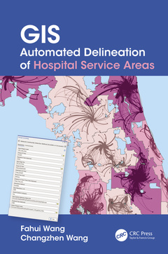
Hospital service areas (HSAs) and hospital referral regions (HRRs) are considered more appropriate units than geopolitical units for analyzing the performance of health care markets and policy implementation. GIS Automated Delineation of Hospital Service Areas represents the state-of-the-art approach in delineating HSAs and HRRs by using GIS-automated processes. It provides the best practices for defining such areas scientifically, in a geographically accurate manner, and without a steep learning curve.
This book is intended to mainly serve professionals in geography, urban and regional planning, public health, and related fields. It is also useful for scholars in the above fields who have research interests related to GIS and spatial analysis applications in health care. It can be used as a supplemental text for upper-level undergraduate and graduate students in courses related to GIS and public health.
Features:
- Introduces innovative state-of-the-art methods for delineation of HSAs (Dartmouth method, Huff model, network community detection methods)
- Provides best practices and one-stop solution for related data processing tasks (e.g., distance and travel time estimation, identifying the best-fitting distance decay function)
- Automates the methods in ArcGIS Pro toolkits
- Includes free ready-to-download GIS tools and sample data available on authors? website
- Presents a methodology that is applicable to delineation of other service areas, catchment areas or functional regions for business analysis, planning, and public policy studies
- Why Hospital Service Areas?
- Estimating Distance and Travel Time Matrices in GIS
- Analysis of Spatial Behavior of Health Care Utilization in Distance Decay
- Delineating Hospital Service Areas by the Dartmouth Method
- Delineating Hospital Service Areas by the Huff Model
- Delineating Hospital Service Areas by Network Community Detection Methods
7. Delineating Cancer Service Areas in the Northeast Region of the U.S.
Fahui Wang, PhD, (ORCID #0000-0001-7765-3024) is Cyril & Tutta Vetter Alumni Professor in the Department of Geography and Anthropology, Louisiana State University. He earned a BS degree in geography from Peking University, China, an MA degree in economics and a PhD degree in city and regional planning from The Ohio State University. His research interests cover human geography (urban, economic, and transportation), public policy (crime and health) and planning. He has published 4 books, 2 edited volumes, and over 140 refereed articles (including co-authorship
Changzhen Wang (ORCID #0000-0002-3065-1168) is PhD Candidate of Geography in the Department of Geography and Anthropology, Louisiana State University. She earned a BS degree from Southwest Jiaotong University and MEng degree from Wuhan University, both in GIS, in China. Her research focuses on development and applications of GIS, computational methods, network analysis and geo-visualization in public health, urban studies, and transportation.
Date de parution : 05-2024
15.6x23.4 cm
Date de parution : 10-2021
15.6x23.4 cm
Thèmes de GIS Automated Delineation of Hospital Service Areas :
Mots-clés :
Zip Code Area; Hospital Service Areas (HSAs); Huff Model; Hospital Referral Region (HRR); Spatial Adjacency Matrix; Service Area Delineation; Click Run; Id Field; Network Optimization Method; Hospital Service Areas; Public Health; Distance Decay Function; Distance Decay Effect; Distance Decay; Dartmouth Atlas; Zip Code; Polygon Layer; Google Map API; Patient Zip Code; Service Flows; Drive Time; Spatial Interaction Model; Network Dataset; Average Travel Time; Service Volumes; Geodesic Distance; Proximal Areas; Travel Time Matrix; Reilly’s Law; Dialog Window