Interpreting Aerial Photographs to Identify Natural Hazards
Auteur : Glass Charles E.
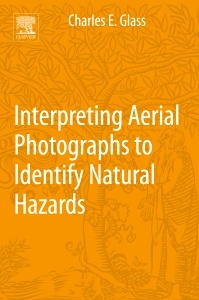
Authored by a world-renowned aerial photography and remote sensing expert, Geographic Aerial Photography: Identifying Earth-Surface Hazards Through Image Interpretation isthe most practical and authoritative reference available for any professional or student looking for a reference on how to recognize, analyze, interpret and avoid ? or successfully plan for ? dangerous contingencies.
Whether they are related to natural terrain, geology, vegetation, hydrology or land use patterns ? it?s critical for you to be able to recognize dangerous conditions when and where they exist. Failure to adequately recognize and characterize geomorphic, geologic, and hydrologic dangers on the ground using aerial photography is one of the major factors contributing to due to natural hazards and disasters, damage to architectural structures, and often the subsequent loss of human life as a result. Aerial photographs provide one of the most prevalent, inexpensive and under-utilized tools to those with the knowledge and expertise to interpret them.
Part 1. Establishing Baselines – Look for the Butterfly
Chapter 1 Getting Started Chapter 2 More About Photographs than You Ever Cared to KnowChapter 3 Textural InformationChapter 4 Color Information
Part 2. Recognizing Hazards on the Ground
Chapter 5 Dangers from Earthquakes and FaultsChapter 6 Dangers from LandslidesChapter 7 Dangers from FloodsChapter 8 Dangers from Ground Subsidence
Part 3 Spectral Ranges Beyond Visible
Chapter 9 The Ultraviolet RegionChapter 10 The Near Infrared RegionChapter 11 The Thermal Infrared RegionChapter 12 The MicrowaveChapter 13 Obtaining Aerial Photographs
Students, scientists, and engineers, real estate executives, developers, construction personnel, land use planners, lawyers, archaeologists, federal, state, and local policy makers and regulators
- Authored by one of the world’s experts in aerial photography and remote sensing, with more than 35 years of experience in research and instruction
- Features more than 100 color photographs to vividly explore the fundamental principles of aerial photography
- Chapter tables underscore key concepts including channel size and shape characteristics, image scales, reverse fault values, and strike-slip fault systems
Date de parution : 08-2013
Ouvrage de 184 p.
15.2x22.8 cm