Lavoisier S.A.S.
14 rue de Provigny
94236 Cachan cedex
FRANCE

Heures d'ouverture 08h30-12h30/13h30-17h30
Tél.: +33 (0)1 47 40 67 00
Fax: +33 (0)1 47 40 67 02


Url canonique : www.lavoisier.fr/livre/autre/digital-methods-and-remote-sensing-in-archaeology/descriptif_3845485
Url courte ou permalien : www.lavoisier.fr/livre/notice.asp?ouvrage=3845485

Digital Methods and Remote Sensing in Archaeology, Softcover reprint of the original 1st ed. 2016 Archaeology in the Age of Sensing Quantitative Methods in the Humanities and Social Sciences Series

Langue : Anglais

Coordonnateurs : Forte Maurizio, Campana Stefano
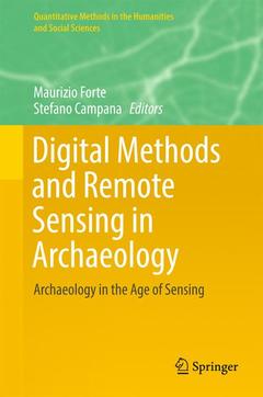
Couverture de l’ouvrage Digital Methods and Remote Sensing in Archaeology
??This volume debuts the new scope of Remote Sensing, which was first defined as the analysis of data collected by sensors that were not in physical contact with the objects under investigation (using cameras, scanners, and radar systems operating from spaceborne or airborne platforms). A wider characterization is now possible: Remote Sensing can be any  non-destructive approach to viewing the buried and nominally invisible evidence of past activity. Spaceborne and airborne sensors, now supplemented by laser scanning, are united using ground-based geophysical instruments and undersea remote sensing, as well as other non-invasive techniques such as surface collection or field-walking survey. Now, any  method that enables observation of evidence on or beneath the surface of the earth, without impact on the surviving stratigraphy, is legitimately within the realm of Remote Sensing. ?The new interfaces and senses engaged in Remote Sensing appear throughout the book. On a philosophical level, this is about the landscapes and built environments that reveal history through place and time. It is about new perspectives?the views of history possible with Remote Sensing and fostered in part by immersive, interactive 3D and 4D environments discussed in this volume. These perspectives are both the result and the implementation of technological, cultural, and epistemological advances in record keeping, interpretation, and conceptualization. Methodology presented here builds on the current ease and speed in collecting data sets on the scale of the object, site, locality, and landscape. As this volume shows, many disciplines surrounding archaeology and related cultural studies are currently involved in Remote Sensing, and its relevance will only increase as the methodology expands. 
Preface.- Acknowledgements.- Introduction.- Chapter 1 Data Collection and Technology.- Chapter 2 Image and Digital Processing.- Chapter 3 Landscape Representation and Scales.- Chapter 4 Simulation, Visualization and Computing.- Chapter 5 Interpretation and Discussion.- Chapter 6 Cultural Resource Management: Communication and Society.
Maurizio Forte is William and Sue Gross Professor of Classical Studies Art, Art History, and Visual Studies at Duke University. He is also the founder of the DIG@Lab (for a digital knowledge of the past) at Duke. His main research topics are: digital archaeology, classical archaeology, and neuro-archaeology. He was professor of World Heritage at the University of California, Merced, (School of Social Sciences, Humanities and Arts) and Director of the Virtual Heritage Lab. He was Chief of Research at Italian National Research Council (CNR) of “Virtual Heritage: Integrated digital technologies for knowledge and communication of cultural heritage through virtual reality systems”, Senior Scientist at CNR’s Institute for Technologies Applied to the Cultural Heritage (ITABC), and Professor of "Virtual Environments for Cultural Heritage" in the Master of Science in Technology-Enhanced Communication for Cultural Heritage at the University of Lugano. He has coordinated archaeological fieldwork and research projects in Italy as well as Ethiopia, Egypt, Syria, Kazakhstan, Peru, China, Oman, India, Honduras, Turkey, USA, and Mexico.  Since 2010 he has been director of the 3D-Digging project at Çatalhöyük.

Stefano Campana is currently MC advanced Research Fellow at the University of Cambridge UK. He is specializing in landscape archaeology, remote sensing, GIS, and archaeological methodology for purposes of research, recording, and conservation. His work is focused on the understanding of past landscapes from prehistory to the present day. The principal context for his work has been Tuscany but he has also participated in and led research work in the UK, Spain, Turkey, Palestine, and Asia. Since 2006 he has been a faculty member of the University of Siena (Italy), in the Department of History and Cultural Heritage, where he has engaged in teaching and research as Senior Lecturer in Ancient Topography. He has been very activ

Shares current research from an innovative field with immediate implications for scholars working in history, archaeology & geoarchaeology, geography, cultural heritage methodology, and the earth sciences more broadly

Represents cross-disciplinary topics at the intersection of the humanities and hard sciences

Includes topics for collecting, interpreting, and sharing data from remote and close range sensing, 3D modeling, spatial technologies, and virtual landscapes ?

Includes supplementary material: sn.pub/extras

Date de parution :

Ouvrage de 496 p.

15.5x23.5 cm

Disponible chez l'éditeur (délai d'approvisionnement : 15 jours).

Prix indicatif 168,79 €

Ajouter au panier

Date de parution :

Ouvrage de 496 p.

15.5x23.5 cm

Disponible chez l'éditeur (délai d'approvisionnement : 15 jours).

Prix indicatif 121,31 €

Ajouter au panier