Lavoisier S.A.S.
14 rue de Provigny
94236 Cachan cedex
FRANCE

Heures d'ouverture 08h30-12h30/13h30-17h30
Tél.: +33 (0)1 47 40 67 00
Fax: +33 (0)1 47 40 67 02


Url canonique : www.lavoisier.fr/livre/sciences-humaines-et-sociales/open-gis/descriptif_4974428
Url courte ou permalien : www.lavoisier.fr/livre/notice.asp?ouvrage=4974428

Open GIS, 1st ed. 2024

Langue : Anglais

Auteurs :

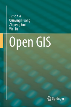
Couverture de l’ouvrage Open GIS
This book provides a comprehensive introduction about recent state-of-the-art advancements in Open GIS, including Open GIS data, services, software, and libraries for GIS programming. Though GIS software has entered the era of Open GIS alongside the emerging trend of open source software, there is no suitable book for GIS educators to teach our next generation, and for professionals to gain an in-depth understanding about Open GIS technologies and toolkits. This book intends to provide this missing guidance for students, educators and professionals in geospatial fields to quickly find, learn and use a wide arrange of open-sourced data, tools, and programming for geospatial applications. 

The book begins with an introduction to open data, and discusses data management solutions, including both open-sourced relational databases and NoSQL database systems for big data. Next, the book covers different GIS and remote sensing software, tools and programming libraries to perform spatial statistics and analyses. Readers will learn about the tools and libraries for desktop and web GIS development for both two dimensional (2D) and three dimensional (3D) mapping and visualization. Finally, the book provides two example of Open GIS applications including public health and natural hazards. At the end of each chapter, practical hands-on exercises are included for readers to fully master the most popular Open GIS technologies introduced in the chapter.
Chapter 1: Open GIS.- Chapter 2: Open Data.- Chapter 3: Open Data Standards and Services.- Chapter 4: DB fundamentals.- Chapter 5: Relational Database.- Chapter 6: NoSQLDatabase for Big Data.- Chapter 7: Vector data processing and analysis.- Chapter 8: Remote Sensing Image Analysis.- Chapter 9: Programming Libraries, APIs and Tools.- Chapter 10: Desktop-based Mapping and Visualization Tools.- Chapter 11: Web-based Mapping and Visualization Packages.- Chapter 12: Open GIS for Public Health.- Chapter 13: Open GIS for Natural Hazards.- Chapter 14: Open GIS for Business. 

Dr Jizhe Xia is an associate professor in the Department of Urban Informatics at Shenzhen University, China. He received his Ph.D. degree in earth systems and geoinformation sciences from George Mason University, in 2015. From 2015 to 2017, he was a Research Assistant Professor with the National Science Foundation (NSF) Spatiotemporal Invitation Center. His research interests include spatiotemporal data structure, spatiotemporal optimization, open-source GIS and their applications in smart city. He published over 60 articles with over 1200 citations. He is the PI of National Natural Science Foundation of China (NFSC) project, National Key R&D Program of China programs sub-project and has received over 4 million RMB research funding since 2017. Dr. Xia teaches courses including: (1) Open-source GIS (undergrade level); Open data, software and computing (graduate level), (2) WebGIS, (3) Data science and data mining, (4) Big Data GIS, and (5) Spatial visualization. In 2019, he received the second prize of GIS teaching competition of China. His teaching experiences are highly relevant to the scope of the proposed book.

Dr. Qunying Huang is an associate professor in the Department of Geography at University of Wisconsin-Madison (UW-Madison). She holds a B.S. from Central South University (2004), M.S. from Peking University (2007) and Ph.D. from George Mason University (2011). Her fields of expertise include Spatial Big Data Analytics and Fusion, Spatial Data Mining, and Spatial Computing. Dr. Huang’s research bridges the gap between Computer and Information Science (CIScience) and GIScience by generating new computational algorithms and methods to make sense of complex spatial datasets. The problem domains of her research are related to human mobility and natural hazards. Dr. Huang published over 90 articles, and edited three books. Her research is primarily sponsored by Department of Energy, National Science Foundation, National Aeronautics and Space Administra

Provides a comprehensive introduction to Open GIS data

Discusses advancements in data, services, software, and libraries for GIS programming

Offers practical hands-on exercises for readers to master the most popular Open GIS technologies

Date de parution :

Ouvrage de 350 p.

15.5x23.5 cm

Disponible chez l'éditeur (délai d'approvisionnement : 15 jours).

147,69 €

Ajouter au panier