Lavoisier S.A.S.
14 rue de Provigny
94236 Cachan cedex
FRANCE

Heures d'ouverture 08h30-12h30/13h30-17h30
Tél.: +33 (0)1 47 40 67 00
Fax: +33 (0)1 47 40 67 02


Url canonique : www.lavoisier.fr/livre/sciences-humaines-et-sociales/multimedia-cartography-2nd-ed/descriptif_2299075
Url courte ou permalien : www.lavoisier.fr/livre/notice.asp?ouvrage=2299075

Multimedia Cartography (2nd Ed., 2nd ed. 2007)

Langue : Anglais

Coordonnateurs : Cartwright William, Peterson Michael P, Gartner Georg
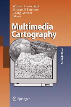
Couverture de l’ouvrage Multimedia Cartography

Multimedia Cartography provides a contemporary overview of the issues related to multimedia cartography and the design and production elements that are unique to this area of mapping. The book has been written for professional cartographers interested in moving into multimedia mapping, for cartographers already involved in producing multimedia titles who wish to discover the approaches that other practitioners in multimedia cartography have taken and for students and academics in the mapping sciences and related geographical fields wishing to update their knowledge about current issues related to cartographic design and production. It provides a new approach to cartography ? one based on the exploitation of the many ?rich media? components and avant-garde approach that multimedia offers.

Multimedia Cartography.- Development of Multimedia.- The Internet and Multimedia Cartography.- Development of Multimedia — Mobile and Ubiquitous.- Elements of Multimedia Cartography.- Designing Suitable Cartographic Multimedia Presentations.- Design of Multimedia Mapping Products.- Map Concepts in Multimedia Products.- Territorial Evolution of Canada — An Interactive Multimedia Cartographic Presentation.- Wula Na Lnuwe’kati: A Digital Multimedia Atlas.- The Atlas of Canada — User Centred Development.- Atlas of Switzerland 2 — A highly interactive thematic national atlas.- AIS-Austria — An Atlas Information System of Austria.- Toward a New Generation of Community Atlases — The Cybercartographic Atlas of Antarctica.- The Employment of 3D in Cartography — An Overview.- Non-Photorealistic 3D Geovisualization.- Real-Time Virtual Landscapes.- Digital Globes.- Augmented Reality as a Medium for Cartography.- Virtual Reality in Urban Planning and Design.- Education and E-Learning with Virtual Landscapes.- Cartography and the use of animation.- Multimodal Analytical Visualisation of Spatio-Temporal Data.- Games and Geography.- Virtual Queenscliff: A Computer Game Approach for Depicting Geography.- Maps and LBS — Supporting wayfinding by cartographic means.- Adaptation in mobile and ubiquitous cartography.- A Real-World implementation of Multimedia Cartography in LBS: The Whereis® Mobile Application Suite.- Standards and Open Source for Cartographic Multimedia Applications.- Scalable Vector Graphics and Web Map Publishing.- Cartographic Approaches to Web Mapping Services.- From Mapping Physical and Human Geographies to Mapping ‘Personal Geographies’: Privacy and Security Issues.- Location and Access: Issues Enabling Accessibility of Information.- Use andUsers of Multimedia Cartography.- Future Directions for Multimedia Cartography.- Postscript to Multimedia Cartography Edition 2.

William Cartwright is Professor of Cartography and Geographical Visualization at RMIT University, Melbourne, Australia, where he specializes in the application of New Media technologies to Cartography. He joined the University after spending a number of years in both the government and private sectors of the mapping industry. He holds undergraduate qualifications in Cartography and graduate qualifications in education, media studies, information and communication technology education and graphic design. He is Vice-President of the International Cartographic Association.

Michael P. Peterson is a Professor in the Department of Geography/Geology at the University of Nebraska at Omaha. He received his B.A. from the University of Wisconsin-River Falls, his M.A. from Boston University and Ph.D. from the State University of New York-Buffalo (1982). He has served as Visiting Professor at Universities in USA, Canada, Germany and Austria. He is past-President of the North American Cartographic Information Society (NACIS). He is currently chair of the Maps and the Internet Commission of the International Cartographic Association.

Georg Gartner is a Professor of Cartography at the Vienna University of Technology. He received his Mag. from the University of Vienna and his Dr. and Habilitation from the Vienna University of Technology. He received a Fulbright Grant to the USA and was a research fellow in Australia and Canada. He currently serves as a vice-chair of the Maps and Internet Commission of the International Cartographic Association and as Editor of the Journal on LBS.

This second edition of Multimedia Cartography includes updated application areas that are Internet-focussed. Since the release of Edition 1 in 1999 the focus of the delivery of Multimedia Cartography applications now includes the World Wide Web and mobile services, as well as discrete media. New chapters in the book reflect this. As well, the book includes additional chapters on 3D applications and Virtual Reality applications.

Date de parution :

Ouvrage de 546 p.

15.5x23.5 cm

Disponible chez l'éditeur (délai d'approvisionnement : 15 jours).

210,99 €

Ajouter au panier

Date de parution :

Ouvrage de 546 p.

15.5x23.5 cm

Sous réserve de disponibilité chez l'éditeur.

210,99 €

Ajouter au panier