Remote Sensing Image Fusion A Practical Guide
Auteurs : Pohl Christine, van Genderen John
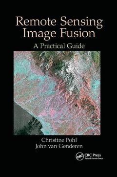
Remote Sensing Image Fusion: A Practical Guide gives an introduction to remote sensing image fusion providing an overview on the sensors and applications. It describes data selection, application requirements and the choice of a suitable image fusion technique. It comprises a diverse selection of successful image fusion cases that are relevant to other users and other areas of interest around the world. The book helps newcomers to obtain a quick start into the practical value and benefits of multi-sensor image fusion. Experts will find this book useful to obtain an overview on the state of the art and understand current constraints that need to be solved in future research efforts. For industry professionals the book can be a great introduction and basis to understand multisensor remote sensing image exploitation and the development of commercialized image fusion software from a practical perspective. The book concludes with a chapter on current trends and future developments in remote sensing image fusion. Along with the book, RSIF website provides additional up-to-date information in the field.
Introduction; Remote sensing; Multi-sensor data; Image and data fusion; Fusion Levels; Data Fusion; Fusion in remote sensing; Sub-pixel level; Pixel level; Feature level; Decision Level; Hybrid level fusion; Pre-processing; Data Selection; Sensor-specific corrections; Geometric Corrections; Image Enhancement; Fusion Techniques; Categorizations of image fusion techniques; The role of colour in image fusion; Component substitutions; Numerical methods; Statistical image fusion; Multi-resolution approaches (MRA); Hybrid techniques; Selection approach; Quality assessment; Image quality parameters; Acceptable quality measures in RSIF; Palubinskas' generic framework for pansharpening quality assessment; Value and requirements for visual evaluation; Conclusions and trends.
Christine Pohl obtained her BSc in geodesy at the Technical University of Braunschweig and continued her MSc at Leibniz University Hannover, in Germany. She earned her PhD in remote sensing from an international program at the International Institute for Aerospace Survey and Earth Sciences (ITC), the Netherlands, together with Leibniz University, Hannover, Germany in 1996. Between 1996 and 1998, she worked as deputy head of the research division at the European Union Satellite Center (EUSC) in Madrid, Spain, followed by a period as an associate professor back at ITC, the Netherlands. From 2002 to 2012, she was as CEO for a private company in Europe, where she was responsible for educational program and provided coaching and leadership training for managers.
Currently, she is a professor at the University of Osnabrueck, Germany. Her research interests cover mainly standardization procedures for remote sensing image and data fusion. She uses remote sensing for applications in the tropics, monitoring oil palm plantations, mapping, change detection, humanitarian crisis support, and coastal zone management. She serves on the technical committees of several international conferences in the field of remote sensing. Christine is an editor for the International Journal of RemoteSensing and is a member of the editorial board of the International Journal ofImage and Data Fusion.
John Van Genderen graduated from the University of Queensland, Brisbane, Australia. He then studied remote sensing at the ITC in the Netherlands for his MSc degree and earned his PhD in remote sensing from the University of Sheffield in the United Kingdom in 1972. Since then, he has carried out research, teaching, projects, and consulting assignments in more than 140 countries around the world. He was a professor of remote sensing at the ITC from 1991 until his retirement in 2009. His main research interests in terms of technology have been i
Date de parution : 12-2019
15.6x23.4 cm
Date de parution : 09-2016
15.6x23.4 cm
Thèmes de Remote Sensing Image Fusion :
Mots-clés :
Remote Sensing Image Fusion; Image Fusion; SAR Image; Remote Sensing; Data Fusion; Remote Sensing Image; Coal Fires; IHS Transform; Data Sets; Ehlers Fusion; Landsat TM; Original Multispectral Image; LiDAR Data; Feature Level Fusion; Rase; Polarimetric SAR; SAR Satellite; Pan Image; Level; Lev El; MS Band; Decision Level Fusion; Obia; PCS; Underground Coal Fires