Lavoisier S.A.S.
14 rue de Provigny
94236 Cachan cedex
FRANCE

Heures d'ouverture 08h30-12h30/13h30-17h30
Tél.: +33 (0)1 47 40 67 00
Fax: +33 (0)1 47 40 67 02


Url canonique : www.lavoisier.fr/livre/sciences-de-la-terre/remote-sensing-image-analysis-including-the-spatial-domain-remote-sensing-et-di-gital-image-processing-vol-5-with-cd-rom/jong/descriptif_1777651
Url courte ou permalien : www.lavoisier.fr/livre/notice.asp?ouvrage=1777651

Remote Sensing Image Analysis: Including the Spatial Domain, 1st ed. 2004. 2nd printing 2006 Remote Sensing and Digital Image Processing Series, Vol. 5

Langue : Anglais

Coordonnateurs : de Jong Steven M., van der Meer Freek D.

Couverture de l’ouvrage Remote Sensing Image Analysis: Including the Spatial Domain

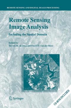
Remote Sensing image analysis is mostly done using only spectral information on a pixel by pixel basis. Information captured in neighbouring cells, or information about patterns surrounding the pixel of interest often provides useful supplementary information. This book presents a wide range of innovative and advanced image processing methods for including spatial information, captured by neighbouring pixels in remotely sensed images, to improve image interpretation or image classification. Presented methods include different types of variogram analysis, various methods for texture quantification, smart kernel operators, pattern recognition techniques, image segmentation methods, sub-pixel methods, wavelets and advanced spectral mixture analysis techniques. Apart from explaining the working methods in detail a wide range of applications is presented covering land cover and land use mapping, environmental applications such as heavy metal pollution, urban mapping and geological applications to detect hydrocarbon seeps.

The book is meant for professionals, PhD students and graduates who use remote sensing image analysis, image interpretation and image classification in their work related to disciplines such as geography, geology, botany, ecology, forestry, cartography, soil science, engineering and urban and regional planning.

Ch 1 - Basics of Remote Sensing Steven M. de Jong, Freek D. van der Meer & Jan G.P.W. Clevers Ch 2 – Spatial Variability, Mapping Methods, Image Analysis and Pixels Steven M. de Jong, Edzer J. Pebesma & Freek D. van der Meer Ch 3 - Sub-Pixel Methods in Remote Sensing Giles M. Foody Ch 4 – Resolution Manipulation and Sub-Pixel Mapping Peter M. Atkinson Ch 5 – Multiscale Object-Specific Analysis (MOSA): An Integrative Approach for Multiscale Landscape Analysis Geoffrey J. Hay & Danielle J. Marceau Ch 6 – Variogram Derived Image Texture for Classifying Remotely Sensed Images Mario Chica-Olmo & Francisco Abara-Hernandez Ch 7 – Merging Spectral and Textural Information for Classifying Remotely Sensed Images Süha Berberoglu & Paul J. Curran Ch 8 – Contextual Image Analysis Methods for Urban Applications Peng Gong & Bing Xu Ch 9 – Pixel-Based, Stratified and Contextual Analysis of Hyperspectral Imagery Freek D. van der Meer Ch 10 – Variable Multiple Endmember Spectral Mixture Analysis for Geology Applications Klaas Scholte, Javier Garcia-Haro & Thomas Kemper Ch 11 – A Contextual Algorithm for Detection of Mineral Alteration Halos with Hyperspectral Remote Sensing Harald van der Werff & Arko Lucieer Ch 12 – Image Segmentation Methods for Object-Based Analysis and Classification Thomas Blaschke, Charles Burnett & Anssi Pekkarinen Ch 13 – Multiscale Feature Extraction from Images Using Wavelets Luis M.T. deCarvalho, Fausto W. Acerbi Jr., Jan G.P.W. Clevers, Leila M.G. Fonseca & Steven M. de Jong Ch 14 – Contextual Analysis of Remotely Sensed Images for the Operational Classification of Land Cover in the United Kingdom Robin M. Fuller, Geoff M. Smith & Andy G. Thomson Ch 15 – A Contextual Approach to Classify Mediterranean Heterogeneous Vegetation Using the Spatial Reclassification Kernel (SPARK) and DAIS7915 Imagery Raymond Sluiter, Steven M. de Jong, Hans van der Kwast & Jan Walstra

Follow-up to the previous publication Imaging Spectrometry - Basic Principles and Prospective Applications (2001) by the same Editors

Shift from spectrally based techniques to spatial-based approaches

Includes supplementary material: sn.pub/extras

Date de parution :

Ouvrage de 359 p.

15.5x23.5 cm

Disponible chez l'éditeur (délai d'approvisionnement : 15 jours).

Prix indicatif 105,49 €

Ajouter au panier

Date de parution :

Ouvrage de 359 p.

15.5x23.5 cm

Sous réserve de disponibilité chez l'éditeur.

Prix indicatif 105,49 €

Ajouter au panier

Thèmes de Remote Sensing Image Analysis: Including the Spatial Domain :