Remote sensing for natural resource mana gement & environmental monitoring, Vol. 4, , (with CD-ROM) (3rd Ed.) Remote Sensing for Natural Resource Management and Environmental Monitoring Manual of Remote Sensing – Third Edition Series, Vol. 11
Langue : Anglais
Coordonnateur : Ustin Susan L.
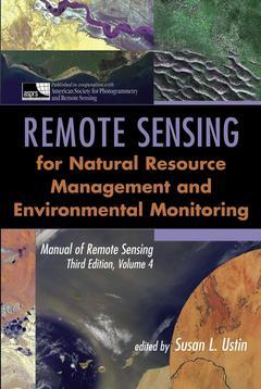
Remote Sensing for Natural Resource Management and Environmental Monitoring is a comprehensive, up—to—date resource for scientists in environmental science, natural resource management, biology, oceanography, academic researchers, and their related support fields. Produced in cooperation with the American Society for Photogrammetry and Remote Sensing, this is the Fourth Volume of the Manual of Remote Sensing, Third Edition, the widely accepted basic reference work in the field. It brings together contributions from an international team of scientists active in remote sensing and natural resource management and environmental monitoring research. This book is divided into four sections. The first section features material on remote sensing ecology of terrestrial forests, rangelands, semi—deserts, and soils, and the second section covers aquatic ecosystems, including rivers and lakes, wetlands, and coastal margin ecosystems. The third section addresses agricultural applications of remote sensing data, including irrigated agriculture, dryland farming, grazing agriculture, and wetland farming. The topics looked at in these chapters overlap and clearly present parallel lines of analysis and common methodologies. Looking forward, the fourth section of this insightful volume covers fundamental issues and new research challenges that require further development to reach fruition for applied environmental research. Complete with a CD—ROM containing more than 160 color figures and hundreds of pages of referencesincluding Internet sourcesthis volume is a major resource for researchers and practitioners working in natural resource management and environmental monitoring.
Preface. Contributors. . Part 1: Remote Sensing of Terrestrial Ecosystems . CHAPTER 1: Remote Sensing of Soils and Soil Processes (Alfredo Huete). 1.1. Introduction. 1.2. Properties Controlling Soil Reflectance. 1.2.1 Biogeochemical Properties. 1.2.2 OpticalGeometric Interactions. 1.2.3 Soil Moisture. 1.3. Deriving Soil Properties at the Landscape Scale. 1.3.1 Direct Measurements. 1.3.2 Landscape Mixtures. 1.3.3 Inferring Soil Properties through Vegetation. 1.3.4 OpticalGeometric Variations. 1.4. Monitoring Soil Processes. 1.4.1 Land Cover and Land Use Change. 1.4.2 Soil Biogeochemistry. 1.4.3 Soil Moisture and Drought. 1.4.4 Soil Degradation Processes. 1.4.5 Soil Erosion Processes. 1.5. Soil Resource Databases. 1.6. Conclusions. References (see CD-ROM). CHAPTER 2: Biophysical Remote Sensing Signatures of Arid and Semiarid Ecosystems (Gregory P. Asner). 2.1 Introduction. 2.1.1 Land Use and Cover Change in Arid and Semiarid Regions. 2.1.2 Remote Sensing of Vegetation Cover and Condition. 2.1.3 Four Optical Remote Sensing Signature Domains. 2.2. Spatial Signatures. 2.2.1 Spatial Resolution. 2.2.2 Landscape Heterogeneity and Spatial Scale. 2.2.3 Landscape Texture. 2.2.4 Categorical and Continuous Fields of Land Cover. 2.2.5 Light Detection and Ranging. 2.3. Spectral Signatures. 2.3.1 Spectral Variability of Earth Surfaces. 2.3.2 Conceptual Model of Landscape Reflectance Variability. 2.3.3 Background Reflectance: Rocks, Soils, and Cryptobiotic Crusts. 2.3.4 Variability of Plant Tissue Optical Properties. 2.3.5 Variability of Canopy Tissue Content. 2.3.6 Variability of Canopy Tissue Orientation. 2.3.7 NPV Variability at Canopy Scales. 2.3.8 Relative Importance of Tissue, Canopy, and Landscape Characteristics. 2.3.9 Spectral Observations of Dryland Regions. 2.4. Angular Signatures. 2.4.1 Introduction and Terminology. 2.4.2 Measurements of Angular Reflectance Signatures. 2.4.3 Angular Signatures as Noise or Knowledge. 2.4.4 Employing Angular Signatures in Arid and Semiarid Regions. 2.5. Temporal Signatures. 2.5.1 Biophysical Change Detection. 2.5.2 Continuous Time Series. 2.5.3 Temporal Mixture Analysis. 2.5.4 Pitfalls and Caveats. 2.6. Thermal-Infrared Signatures. 2.6.1 Background. 2.6.2 Temperature Applications. 2.6.3 Emissivity Applications. 2.7. Fusion of Signature Domains. 2.8. Acknowledgments. References (see CD-ROM). CHAPTER 3: Remote Sensing in Arid Regions: Challenges and Opportunities (Gregory S. Okin and Dar A. Roberts). 3.1. Introduction. 3.2. Remote Sensing Applications in Desert Areas. 3.2.1 Remote Sensing of the Extent of the Sahara Desert. 3.2.2 Land Use, Land Cover, and Land Degradation. 3.2.3 Applications of Remote Sensing to Desert Geomorphology. 3.2.4 Atmospheric Remote Sensing in Arid Regions. 3.3. Remote Sensing Techniques in Deserts. 3.3.1 High-Resolution Remote Sensing. 3.3.2 Multispectral and Hyperspectral Remote Sensing. 3.3.3 Multitemporal Remote Sensing. 3.3.4 Radar and Microwave Remote Sensing. 3.4. Remote Sensing in Arid Regions: Challenges and Limitations. 3.4.1 Summary. 3.5. Case Study: Manix Basin, San Bernardino County, California. 3.5.1 Retrieval of Vegetation Information from Remote Sensing Imagery. 3.5.2 Summary: Land Degradation in the Manix Basin. 3.6. Conclusions. References (see CD-ROM). CHAPTER 4: Temperate and Boreal Forests (Eric S. Kasischke, Scott Goetz, Matthew C. Hansen, Mutlu Ozdogan, John Rogan, Susan L. Ustin, and Curtis E. Woodcock). 4.1. Introduction. 4.1.1 Temporal and Spatial Resolution and Sensor Choice. 4.2. Coarse-Resolution Optical Systems. 4.2.1 History of AVHRR and NDVI Monitoring. 4.2.2 Calibration and Validation Issues for AVHRR. 4.2.3 Mapping of Vegetation Cover and Characteristics. 4.2.4 Continuous Fields of Vegetation. 4.2.5 Monitoring and Mapping of Fires. 4.2.6 Monitoring and Mapping Other Large-Scale Disturbances. 4.3. High-Resolution Optical Systems. 4.3.1 Common Methods for Analysis of High-Resolution Data. 4.3.2 Forest Composition. 4.3.3 Forest Structure. 4.3.4 Forest Biophysics. 4.3.5 Forest Biochemistry. 4.3.6 Forest Health. 4.3.7 Monitoring Forest Change. 4.4. Microwave Remote Sensing Systems. 4.4.1 Origins of Microwave Signatures from Forested Landscapes. 4.4.2 Characteristics of Microwave Systems. 4.4.3 Land Cover Mapping. 4.4.4 Estimation of Aboveground Biomass. 4.4.5 Monitoring Soil and Vegetation Moisture Characteristics. 4.4.6 Monitoring Temperature-Related Effects. 4.5. New and Emerging Technologies. 4.5.1 Very High Spatial Resolution Data. 4.5.2 Lidar. References (see CD-ROM). CHAPTER 5: Tropical Forests (Richard M. Lucas, Alexander A. Held, Stuart R. Phinn, and Sassan Saatchi). 5.1. Introduction. 5.1.1 Tropical Forests: Past and Present. 5.1.2 Remote Sensing of Tropical Forests. 5.1.3 Chapter Outline. 5.2. Characteristics of Tropical Forests. 5.2.1 Definitions of Tropical Forests. 5.2.2 Importance of Tropical Forests. 5.3. Remote Sensing Instruments: Past and Present. 5.3.1 Importance of Spatial Resolution. 5.3.2 Temporal Resolution. 5.3.3 Exploiting the Electromagnetic Spectrum: Passive Sensors. 5.3.4 Exploiting the Electromagnetic Spectrum: Active Sensors. 5.4. Factors Complicating Remote Sensing of Tropical Forests. 5.4.1 Cloud Cover, Atmospheric Conditions, and Rainfall Events. 5.4.2 Forest Boundary Definition. 5.4.3 Subpixel Forest Cover. 5.5. Biophysical Properties. 5.5.1 Canopy Cover, Composition, and Dynamics. 5.5.2 Three-Dimensional Structure of Forests. 5.5.3 Biomass of Tropical Forests. 5.5.4 Leaf Characteristics. 5.5.5 Field Measurements. 5.6. Forests Condition. 5.6.1 Undisturbed Forests. 5.6.2 Disturbed Forests. 5.7. Forest Degradation. 5.7.1 Positive Feedbacks Leading to Degradation. 5.7.2 Indicators of Forest Degradation. 5.8. Forest Regeneration. 5.8.1 Reflectance Characteristics of Regenerating Forests. 5.8.2 Time-Series Data Sets for Discriminating and Mapping Regeneration Age and Pathway. 5.8.3 Land Use Impacts on Tropical Forest Regeneration. 5.8.4 Characterizing Regeneration Stage Using SAR Data. 5.9. Major Initiatives in Tropical Forest Remote Sensing. 5.9.1 Tropical Ecosystem Environment Obser
SUSAN L. USTIN, PhD, is Professor of Resource Science in the Department of Land, Air, and Water Resources at University of California, Davis. She is also Director of the Western Regional Center for Global Environmental Change (WESTGEC), and Director of the UCD California Space Institute Center of Excellence and the Center for Spatial Technologies and Remote Sensing (CSTARS), both at UC Davis.
Date de parution : 05-2004
Ouvrage de 880 p.
18.4x26.2 cm
Thème de Remote sensing for natural resource mana gement &... :
Mots-clés :
remote; monitoring; sensing; comprehensive; natural; scientists; environmental; resource; science; fields; society; cooperation; photogrammetry; american; manual; volume; fourth; reference; field; work; basic; international; team
© 2024 LAVOISIER S.A.S.