Geospatial Science for Smart Land Management An Asian Context
Coordonnateurs : Timo de Vries Walter, Rudiarto Iwan, Piyasena N.M.P. Milinda
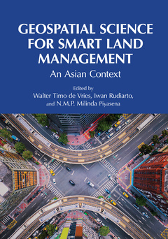
Responsible land distribution in Asia, with ever-increasing limitations in space, requires the use of smart technologies, sophisticated models, intelligent algorithms, and big data repositories. This book presents new land management perspectives and fit-for-purpose, flexible, dynamic, and effective solutions for land management and land administration problems. Written by global experts from different Asian countries, including China, India, Indonesia, Iran, Japan, South Korea, Thailand, Vietnam, etc., all these cases demonstrate how and why the uptake of geospatial technologies is booming and how to handle land scarcity and competing spatial interests in both urban and rural areas in Asia.
FEATURES
- Summarizes trends of geospatial technologies in Asia
- Describes and applies leading-edge geospatial models
- Explains fit-for-purpose digital land administration
- Provides case studies and examples that include the use of smart land management tools
- Helps readers advance their understanding of geospatial and land management science
Truly an interdisciplinary book, this text is a practical guide for an array of readers, such as practitioners in public and private companies involved in both geospatial and land management applications, as well as graduate students, researchers, academics, and professionals working in land administration, land management, spatial planning, real estate studies, geosciences, geoinformatics, and geodesy.
Section I: Introduction to Geospatial Science and Smart Land Management. 1. Geospatial Science for Smart Land Management in Asia. Section II: New Developments and Concepts in Geospatial Technologies. 2. Trends in Geospatial Technologies in Asia. 3. Advancing Geospatial Technology to Construct Fit-for-Purpose Land Administration and Land Management in ASEAN Countries. 4. The Congruence and Conflicts of Spatial Data Infrastructure and Cadastral Agricultural Systems in Pakistan. 5. Digital Transformation in Indonesian Land Administration: Further Developments and Directions. 6. Urban Growth Modelling for a City Built from Scratch—Case Study of the New Indonesian Capital. 7. Developments of 3D Cadastres in the Asian Context. 8. Flood Modelling and Prediction towards Smart Land Management in Sri Lanka. 9. Machine Learning and Metaheuristic Optimization Algorithms for Land Cover Classification. Section III: New Developments and Requirements of Smart Land Management. 10. Trends in Smart Land Management and Smart Spatial Planning in Asia: Case Study of the New Capital City of Indonesia. 11. Evaluate the Existing Proposals of Re-Engineering the Land Administration System in Sri Lanka against the Fit-for-Purpose Approach. 12. A Review of Sri Lanka’s National Spatial Data Infrastructure (SL-NSDI) with the Aim of Enhancing Its Functionalities. 13. Digital Administration of Land Data—A Case from National Housing and Urban Development Corporation. 14. Reducing Rural Boundary Conflict through Participatory Mapping and GNSS-GIS. 15. An Analysis of Urban and Rural Development for the Conception of a National Spatial Plan in Thailand. 16. Drone Technology, Rapid Titling, and Value Creation: Early Insights from India’s SVAMITVA Scheme. Section IV: Cases and Practical Applications of Smart Land Management, Smart Land Administration, Smart Spatial Planning. 17. Geospatial Application of Open Geospatial Data Analysis for Land Use-Change Detection—A Case Study from Japan. 18. Assessment of Urban Patterns Using Spatial Metrics and Prediction of Urban Growth: A Case Study of Kabul, Afghanistan. 19. A Geospatial Analysis for an Integrated Land Use and Water Strategy for Bagmati River in Kathmandu Valley, Nepal. 20. Developments in Geospatial Sciences for Smart Land Management in China: Theory and Practice. 21. Accuracy Assessment of the Drone Survey Parameters for Cadastral Purposes. 22. Artificial Intelligence (AI) Assisted Precision Agriculture: Applications in Asian Context. 23. The Dynamics of Village Land Management: A Case from Central Java, Indonesia. 24. Toll Road Construction and Its Impact on Paddy Fields, Production and the Regional Development of the Semarang-Surakarta Corridor, Indonesia. 25. Jam Tomorrow: Towards Sustainable Coastal Urban Development in the Era of Uncertainty. Section V: Future Challenges of Geospatial Science for Smart Land Management. 26. Ethical and Legal Issues Affecting Geospatial Sciences and Advances in Smart Land Management. 27. Advancing Research in Geospatial Sciences for Land Management in Asia.
Walter Timo de Vries has served as Chair of Land Management at the Technical University of Munich (TUM) since 2015. He is the Academic Program Director Geodesy and Geoinformation and Director of the master’s and PhD programs in land management and geospatial science. He has worked in numerous international projects in Asia, Africa, and South America dealing with land information and land reform, urban and rural development, geospatial data infrastructures, and professional training and education in land issues, cadastre, and spatial planning and development. His current research interests include smart and responsible land management, urban and rural development, and land consolidation. He has published several books with CRC Press/Taylor & Francis Group.
Iwan Rudiarto is a Professor in the Department of Urban and Regional Planning, Universitas Diponegoro (UNDIP), Semarang, Indonesia. His expertise is in rural planning and development, land management, and GIS modeling. Currently, he is teaching and supervising students in bachelor’s, master’s, and doctoral programs in urban and regional planning at UNDIP. He is actively involved in the Global Center of Spatial Methods for Urban Sustainability (GCSMUS) as an advanced researcher as well as the representative of Indonesia with its coordination base at the Technical University of Berlin, Germany. He is also the president of the Indonesian Planning Schools Association.
N.M.P. Milinda Piyasena is a Senior Lecturer in the Faculty of Geomatics, Sabaragamuwa University, Balangoda, Sri Lanka. He is also the founder and coordinator of the GeoTech-HIB, Faculty of Geomatics. His research interests include the development of LADM-based land information systems and 3D cadastre systems and ABSM techniques for urban planning land tenure security enhancement. He has published two books and is engaged in several local development projects related to land information systems and local SDI as well a
Date de parution : 12-2023
17.8x25.4 cm
Thèmes de Geospatial Science for Smart Land Management :
Mots-clés :
Land Tenure; Land Acquisition; Land Rights; Urban Development; Real Estate Management; Land Information System; Cadastre; Land Registration; Fit-For-Purpose Land Administration; Spatial Analysis; GIS; Citygml; OGC; City Planning; Urban Planning; Rural Planning; Housing; Spatial Patterns; Spatial Equity; Infrastructure; Mobility; Environmental Impact Assessment; Ecology; Ecological Zones