Geoinformatics in Applied Geomorphology
Coordonnateurs : Anbazhagan Siddan, Subramanian S.K., YANG XIAOJUN
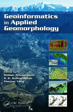
With recent innovations in the arena of remote sensing and geographic information systems, the use of geoinformatics in applied geomorphology is receiving more attention than ever. Geoinformatics in Applied Geomorphology examines how modern concepts, technologies, and methods in geoinformatics can be used to solve a wide variety of applied geomorphologic problems, such as characterization of arid, coastal, fluvial, aeolian, glacial, karst, and tectonic landforms; natural hazard zoning and mitigations; petroleum exploration; and groundwater exploration and management.
Using case studies to illustrate concepts and methods, this book covers:
- Arid environments, such as the Thar desert, West Texas, the Qatar Peninsula, and the Dead Sea areas
- Coastal shoreline changes in Kuwait
- Coastal zone management in India
- Estuarine bathymetric study of Tampa Bay, Florida
- Fluvial landforms of the Elbe river basin, Germany
- Subsurface coastal geomorphology and coastal morphological changes due to tsunamis in the East coast of India
- The Himalayas, Jammu & Kashmir, Western Ghats, and Precambrian terrain of South India
The result of extensive research by an interdisciplinary team of contributors, Geoinformatics in Applied Geomorphology is designed for students, researchers, and professionals in the areas of geomorphology, geological engineering, geography, remote sensing, and geographic information systems.
Geoinformatics: An Overview and Recent Trends. Airborne Laser Scanning and High-Resolution Satellite Data for Geomorphological Mapping in Parts of Elbe River Valley, Germany. Geoinformatics in Spatial and Temporal Analyses of Wind Erosion in Thar Desert. Remote Sensing and GIS for Coastal Zone Management: Indian Experience. Kuwait Coastline Evolution during 1989–2007. Detecting Estuarine Bathymetric Changes with Historical Nautical Data and GIS. High-Resolution Mapping, Modeling, and Evolution of Subsurface Geomorphology Using Ground-Penetrating Radar Techniques. Remote Sensing in Tectonic Geomorphic Studies: Selected Illustrations from the Northwestern Frontal Himalaya, India. Strain Accumulation Studies between Antarctica and India by Geodetically Tying the Two Continents with GPS Measurements. Indian Ocean Basin Deformation Studies by Episodic GPS Campaigns in the Islands Surrounding India. Remote Sensing and GIS in Groundwater Evaluation in Hilly Terrain of Jammu and Kashmir. Remote Sensing in Delineating Deep Fractured Aquifer Zones. Remote Sensing and GIS for Locating Artificial Recharge Structures for Groundwater Sustainability. A Fuzzy Arithmetic Approach to Characterize Aquifer Vulnerability Considering Geologic Variability and Decision-Makers’ Imprecision. Remote Sensing and GIS in Petroleum Exploration. Geoinformatics in Terrain Analysis and Landslide Susceptibility Mapping in Part of Western Ghats, India. Impact of Tsunami on Coastal Morphological Changes in Nagapattinam Coast, India. Remote Sensing for Glacier Morphological and Mass Balance Studies. Geomorphology and Development Mechanism of Sinkholes in Arid Regions with Emphasis on West Texas, Qatar Peninsula, and Dead Sea Area. Index.
Prof. Siddan Anbazhagan is Director, Centre for Geoinformatics and Planetary studies, and Head, Department of Geology at Periyar University, India. He obtained PhD from Bharathidasan University (1995) and was awarded an Alexander von Humboldt Fellowship for his post-doctoral research in Germany. Dr. Anbazhagan’s research interests include remote sensing and GIS for applied geomorphology, hydrogeology and disaster mitigation. His current area of interest is planetary remote sensing. His research has been funded by ISRO, DST, MHRD and UGC. Anbazhagan has authored or co-authored more than 60 publications including an edited book on Exploration Geology and Geoinformatics. He serves as a reviewer for several remote sensing, environmental and water resources journals. He currently serves as Syndicate member and Coordinator for Research & Development in the Periyar University.
Dr. S.K.Subramanian is a Senior Scientist, heading Hydrogeology Division at National Remote Sensing Centre (NRSC), Hyderabad, India, Indian Space Research Organization (ISRO). He completed his higher education from IIT Bombay and Indian School of Mines. Dr. Subramanian has more than 30 years of professional experience in Remote Sensing and Geomorphology. He has coordinated number of National mission projects including Integrated Mission for Sustainable Development (IMSD), National (Natural) Resources Information System (NRIS), Rajiv Gandhi National Drinking Water Mission (RGNDWM) and National Agricultural Technology Project (NATP) especially in Geomorphology and Groundwater. In addition, he has been involved in several research projects including geomorphologic evolution of West Coast, mass movement in the Kosi catchment, geomorphology of Nepal, Chambal Ayacut of Rajasthan state and integrated studies and mapping of Dubai, UAE. He has authored or co-authored nearly 50 publications.
Xiaojun Yang is within the Geography De
Date de parution : 06-2011
15.2x22.9 cm
Disponible chez l'éditeur (délai d'approvisionnement : 15 jours).
Prix indicatif 232,80 €
Ajouter au panierDate de parution : 04-2017
15.2x22.9 cm
Disponible chez l'éditeur (délai d'approvisionnement : 14 jours).
Prix indicatif 96,92 €
Ajouter au panierThèmes de Geoinformatics in Applied Geomorphology :
Mots-clés :
RS Data; Coastal Geomorphology; Surface temperature mapping; LISS Iii; Spectral reflectance; Remote Sensing; Lunar analog rocks; Gps Data Processing; Crustal stress; Gps Data; Well collapse; Tamil Nadu; Tertiary sediments; Indian Ocean Basin; Benthic formations; Indian Plate; Nappe sheets; Beach Ridges; Horizontal gliding; Geomorphic Units; Gps Campaign; Trend NW SE; Gandhi National Drinking Water Mission; Plate Boundary; Recharge Conditions; NW SE Direction; ALS Data; SDSS; ALS; Hillsborough Bay; IGS Station; Potential Fishing Zone; Recharge Structures; High Resolution Satellite Data