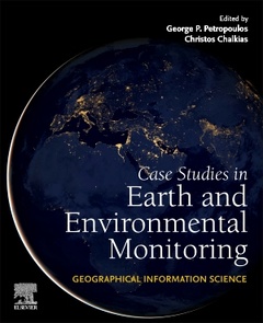
Geographical Information Science Case Studies in Earth and Environmental Monitoring
Coordonnateurs : Petropoulos George P., Chalkias Christos

Geographical Information Science: Case Studies in Earth and Environmental Monitoring provides detailed remote sensing and GIS methods and algorithms and technology comparisons, focusing on a wide range of environmental applications. The geoinformation technologies are demonstrated through templated case studies detailing real world use of the techniques and clarifying methods, tools, and practical solutions to environmental mapping and monitoring. The book utilizes remote sensing and geospatial data from the most recently launched satellites and applies the latest geospatial data approaches and analysis software tools (both commercial and open source). This book is a comprehensive reference for researchers, academics and technicians in the fields of geospatial science & technology, remote sensing, and environmental science; or those processing and analyzing geospatial data for monitoring and modelling.
1 .Land cover mapping 2. Snow & snow melting mapping 3. Digital Surface Modelling: assessment of different models 4. Geomorphological properties/features mapping 5. Heavy metals pollution on soils 6. Mapping landscape naturality (ecosystem services, ecology) 7. Soil properties mapping 8. Evapotranspiration retrievals from crops 9. Soil degradation from cultivation processes 10. Crop yield modelling 11. Precision agriculture and geoinformatics 12. Wetlands (properties) mapping 13. Coastal areas (properties) mapping 14. Bathymetry &/or lake water properties mapping 15. Sea level rise and climate change 16. Urban green cover (or Impervious surface area) mapping 17. Sustainable energy sources in urban environment 18. Urban expansion mapping (Urban Heat Island) 19. Mapping nightlight pollution 20. Air quality (/pollution) mapping 21. Air pollution mapping 22. Mapping noise pollution 23. Covid 19 & air pollution 24. Frost mapping 25. Wildfires mapping & recovery 26. Post-fire vegetation regrowth mapping 27. Floods mapping & damage assessment (or runoff modelling) 28. Landslide susceptibility assessment and mapping
Dr. Christos Chalkias is professor of Applied Geography and GIS in Harokopio Univeristy of Athens, Department of Geography. He is a former Chair of the Department and is currently Vice Rector of Research, Development and Life Lind Education in Harokopio University of Athens. Dr. Chalkias has over 25 years of experience specializing in education and research in Geographical Information Systems and science, geoinformatics, digital cartography, applied geography and spatial analysis in both natural and human environments. He has published hundreds of papers in major scientific journals, conference proceedings as well as books and book chapters. Over the last 25 years he has participated in over 40 research projects with major contributions to various GIS applications.
- Focuses on global, templated case studies of GIS applications to environmental monitoring
- Includes methodologies allowing readers to recreate techniques and models and workflows that can be used in their own work
- Covers a plethora of topics in applied geosciences, providing environmental and geographical applications of practical interest
Date de parution : 06-2024
Ouvrage de 370 p.


