The Role of GIS in COVID-19 Management and Control
Coordonnateur : Ozdenerol Esra
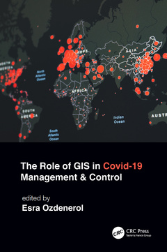
Geographic Information System (GIS) is one of the most important tools to help us understand public health and many aspects of our lives. Because of COVID-19, GIS has been brought into the spotlight more than ever before. People and civic leaders worldwide are turning to maps and real-time surveillance data to make sense of what has been happening in the world and to get answers to important questions on every aspect of this pandemic. This book examines the role of GIS in managing and controlling the spread of COVID-19 through 12 global projects and a multidisciplinary approach. It explains the innovative uses of GIS not only limited to data organization and data access, but also how improved GIS tools are used to make decisions, plan, and communicate various measures of control in both local and full-scale outbreaks during the COVID-19 pandemic.
Features:
- Provides cutting-edge GIS visualization, spatial temporal pattern, and hot spot tracking applications used for predictive modeling of COVID-19.
- Includes real-world case studies with broad geographic scope that reflect COVID-19 trends in cases, deaths, and vaccinations.
- Provides lifestyle segmentation analysis on the risk of transmission of COVID-19 and spatial patterns of vaccination hesitancy.
- Highlights real-world issues brought to light with the help of GIS, such as social discrimination, inequalities in women?s access to mental health care, and analyzes the risk of transmission due to vaccination hesitancy.
- Shows the use of GIS and spatial analysis in pandemic mapping, management, and control from masking and social distancing to testing site locations accounting for at-risk and vulnerable populations.
- Discusses facilitating policy making with GIS.
Edited by a very talented medical geographer and GIS Professor Dr. Esra Ozdenerol, this book highlights key GIS capabilities and lessons learned during the COVID-19 response that can help communities prepare for the next crisis. It is a great resource for industry professionals and experts in health care, public health and safety, disaster management, and for students, academics, and researchers interested in applying GIS and spatial analysis to the study of COVID-19 and other pandemics.
1. The Role of GIS in COVID-19 Management and Control 2. Information Access as a Strategy to Overcome Health Inequities in the Context of COVID-19 3. Spatial Pattern of COVID-19 Positivity Rates in Indonesia during Local Restriction Phase: A Case study of Jakarta and Surabaya City 4. Investigating Spatial Relationships of Age and Comorbidities on COVID-19 Spread Using Geographically Weighted Regression 5. Spatiotemporal Patterns of Covid-19: A District-level Analysis of Kerala, India, 2020-2021 6. The 2020 Hurricanes, Internal Displacements and COVID-19 in Latin America and the Caribbean Countries: Lessons Learned for Disaster Risk Reduction 7. Hot Spot Tracker: Detecting and Visualizing the Types of Spatiotemporal Hot Spots of COVID-19 in the United States 8. Lifestyle Effects on the Risk of Transmission of COVID-19 in the United States: Evaluation of Market Segmentation Systems 9. A Bibliometric Review of Research on the Role of GIS in COVID19 Pandemic Control and Management: Science Mapping the Literature, 2020 – 2022 10. The Use of Geographic Information Systems to Shape COVID Policies Regarding Masking and Distancing with A Partially Vaccinated Population 11. Using GIS to Map Women’s Health, Well-being and Economic Opportunities in the Context of COVID-19 12. The Effects of Lifestyle on COVID-19 Vaccine Hesitancy in the United States: An Analysis of Market Segmentation 13. A Gendered Approach to Examining Pandemic Induced Livelihood Crisis in the Informal Sector: the Case of Female Domestic Workers in Titwala
Dr. Esra Ozdenerol is a professor in the Department of Earth Sciences at the University of Memphis and has been since 2003. She is also affiliated with the Departments of Preventive Medicine and Health Outcome Policy of the University of Tennessee Health Science Center. She is the director of the GIS Certificate Program at the University of Memphis, and she directs the Spatial Analysis and Geographic Education Laboratory in the Department of Earth Sciences. Dr. Ozdenerol was the associate director of Benjamin L. Hooks Institute for Social Change at the University of Memphis from 2010 to 2013. She earned her doctorate degree in Geography in 2000 and her Master of Landscape Architecture degree in 1996 from the Louisiana State University. She earned her Bachelor of Science degree in Landscape Architecture and Agricultural Engineering from the University of Ankara, Turkey. Before joining the University of Memphis, she was an assistant professor of architecture at Florida International University in Miami from 2000 to 2003. Dr. Ozdenerol specializes in geographic information systems and has served as a technical consultant to various public, governmental, and international agencies. Her latest publications are on studies about spatial health inequalities. She has published two books with Taylor & Francis - Spatial Health Inequalities: Adapting GIS Tools and Data Analysis (2016) and Gender Inequalities: GIS approaches to Gender Analysis (2021).
Date de parution : 05-2023
15.6x23.4 cm
Thèmes de The Role of GIS in COVID-19 Management and Control :
Mots-clés :
Geoinformation; CDC; Geospatial analysis; Public health; Pandemic control; Mobility Data; Vaccine Hesitancy; GWR Analysis; Target Zip Code; High Low Outliers; Low Vaccine Uptake; Tamil Nadu; Young Men; Vaccination Hesitancy; Data Sets; DKI Jakarta; Vice Versa; GWR Model; Internal Displacements; Lac Country; Surabaya City; Internal Displacements Monitoring Centre; Random Forest Model; Welch ANOVA; Vaccination Rates; Low Risk Clusters; Author Keywords; Shelby County; Mann Kendall Test; MMR; Hurricane Iota