GIS and Geostatistical Techniques for Groundwater Science
Coordonnateurs : Venkatramanan Senapathi, Viswanathan Prasanna Mohan, Chung Sang Yong
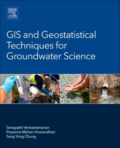
GIS and Geostatistical Techniques for Groundwater Science provides a detailed synthesis of the application of GIS and geostatistics in groundwater studies. As the book illustrates, GIS can be a powerful tool for developing solutions for water resource problems, assessing water quality, and managing water resources. Beginning with an introduction to the history of GIS and geostatistical techniques in groundwater studies, the book then describes various spatial techniques, including case studies for various applications, from quality assessment, to resource management. This book assembles the most up-to-date techniques in GIS and geostatistics as they relate to groundwater, one of our most important natural resources.
Introduction and History of GIS and Geostatistical Techniques in Groundwater Science 1. Fundamentals of GIS 2. General Introduction of Geostatistical Techniques 3. History of GIS and Geostatistical techniques in groundwater science 4. Merits and Demerits of GIS and Geostatistical Techniques
Types of Geospatial Analysis Techniques 5. Introduction of various spatial analyses 6. Inverse distance weighted and Kriging 7. Spline 8. Fuzzy 9. Cluster and Grouping Analysis 10. Correlation and Regression 11. Time Series Analysis 12. Artificial Neural Network
Groundwater quality assessment using GIS and Geostatistical aspects 13. Groundwater contaminations related with climate change 14. Groundwater quality contamination related with urbanization 15. Groundwater and Surface Water Interaction 16. Groundwater Contamination Related to Seawater Intrusion 17. Organic Contamination (Hydrocarbon, LNAPL, DNAPL) 18. Fluoride contamination 19. Arsenic contamination 20. Heavy metal contamination
Application of GIS and Geostatistical techniques in groundwater resources management 21. Groundwater, River basin, Watershed management 22. Water management for agricultural utilization
Geologists, Geophysicists, Geochemists, Environmentalists, Hydrogeologists, Soil scientists, environmental engineers
Dr M.V. Prasanna is an Associate Professor at Curtin University, Malaysia. He completed his Ph.D in 2008 at Annamalai University, India. He was a gold medallist in Post graduate degree. He has qualified State Educational Test (SET) under University Grants Commission (UGC), India for lectureship. He has 15 years of teaching and research experience and produced 2 PhD and 2 M.Phil students under his guidance. He has published 86 Journal papers and 8 book chapters, indexed in Thomson Reuters and Scopus. Recently, he has edited a book on GIS and Geo-statistical Techniques for Groundwater Science and published by Elsevier in June 2019. Currently, he is editing a two special issues on recent environmental geochemical trends in water and sediments – a framework on OSPRC 2020 in Environmental Science and Pollution Research Journal.
Prof. Sang Yong Chung is a full Professor in the Department of Earth & Environmental Sciences, Pukyong National University in Busan City of Korea. He accomplished the Ph.D. program in Hydrogeology from the Department of Geological Sciences, University of Nevada at Reno, U.S.A. He was interested in the modeling of groundwater data such as aquifer parameters, water level and water quality using geo-stati
- Provides details on the application of GIS and statistics in groundwater studies
- Includes practical coverage of the use of spatial analysis techniques in groundwater science
- Bridges the gap between geostatistics and GIS as it relates to groundwater science and management
- Offers worldwide case studies to illustrate various techniques and applications in addressing groundwater issues
Date de parution : 05-2019
Ouvrage de 389 p.
21.5x27.6 cm