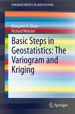
Basic Steps in Geostatistics: The Variogram and Kriging, 2015 The Variogram and Kriging SpringerBriefs in Agriculture Series
Auteurs : Oliver Margaret A., Webster Richard

1. Introduction
1.1. Background to Geostatistics
1.2. Applications of geostatistics
1.2.1. Mining and Engineering
1.2.2. Environmental Pollution
1.2.3. Precision Agriculture
1.2.4. Fisheries
1.3. Sampling
1.3.1. The Domain
1.3.2. The Variables
1.3.3. Units and Support
1.3.4. Practical Matters
1.4. The Essence of Geostatistics
2. Regionalized Variable Theory
2.1. Random Variables and Regionalized Variable Theory
2.1.1. Stationarity
3. The Variogram and Modelling
3.1. The Experimental Variogram
3.1.1. Computing the Variogram from Regular Sampling in One Dimension
3.1.2. Computing the Variogram from Sampling in Two Dimensions
3.2. Factors Affecting the Reliability of Experimental Variograms
3.2.1. Sample Size
3.2.2. Sampling Interval and Spatial Scale
3.2.3. Lag Interval and Bin Width
3.2.4. Statistical Distribution
3.2.5. Anisotropy
3.2.6. Trend
3.3. Modelling the Variogram
3.3.1. Principal Features of the Variogram
3.3.2. Variogram Model Functions
3.4. Factors Affecting the Reliability of Variogram Models
3.4.1. Fitting Models
4. Geostatistical Prediction: Kriging
4.1. Introduction
4.2. Theory
4.2.1. Kriging Weights
4.2.1.1. Effect of the Ratio of the Nugget:Sill Variances
4.2.1.2. Changing the Range
4.2.1.3. Block Kriging
4.2.1.4. Kriging with Irregularly Scattered Data
4.2.2. Kriging Neighbourhood
4.2.2.1. Effect of the Kriging Neighbourhood
4.2.3. Punctual and Block Kriging for Mapping
4.2.4. Anisotropy
4.2.5. Simple Kriging
4.2.6. Lognormal Kriging
4.3. Cross-validation
4.4. Summary
5. Sampling
5.1. Sampling for the Variogram
5.1.1. Nested Sampling
5.1.1.1. Illustrative Example: Nested Sampling in the Wyre Forest
5.2. Sampling Plans for Mapping
5.2.1. Illustrative Example: Sampling to Map Chromium in the Swiss Jura
5.3. Summary
6. Dealing with Trend
6.1. Trend
6.1.1. Variogram and Model
6.2. Example
6.3. Illustration from a Case Study
6.4. Summary
Takes readers through the essential steps in computing and modelling the variogram, which is often done in a black-box environment that does not lead to an understanding of the spatial variation
Short computer code to guide users in GenStat as a learning medium
Unique and succinct information
Includes supplementary material: sn.pub/extras
Date de parution : 04-2015
Ouvrage de 100 p.
15.5x23.5 cm
Thèmes de Basic Steps in Geostatistics: The Variogram and Kriging :
Mots-clés :
Field sampling; Kriging; Spatial analysis; Spatial variation; Variogram


