Sundarbans Mangrove Systems A Geo-Informatics Approach
Coordonnateurs : Mukhopadhyay Anirban, Mitra Debashis, Hazra Sugata
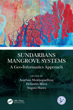
Sundarbans, a UNESCO heritage site, is the world?s largest single chunk of mangroves distributed on the Indian and Bangladesh coasts. The mangroves and associated ecosystems are one of the most fertile ecosystems of the earth. Sundarbans Mangrove Systems: A Geo-Informatics Approach portrays different perspectives of studying Sundarbans and mangroves using geospatial analysis. This book highlights the major issues with the Sundarbans mangrove forest, its future conservation strategies and its ecological importance using geo-informatics technology. It explains the usage of remote sensing data for providing information about the present state of mangroves and their tropic status, including assessment in terms of extent, density of community, condition, diversity, identifying potential habitats and heterogeneity. Furthermore, it discusses the use of hyperspectral remote sensing data for species level classification of mangroves, community zonation for biodiversity assessment and for preparing management plans for conservation.
KEY FEATURES
- Exclusively covers the ecological state of Sundarbans (mangrove systems) through geo-informatic studies
- Describes the application of a combination of geomorphological, biogeochemical and remote sensing methods to the analysis of temporal changes
- Includes environmental factors affecting the health and decline of mangroves
- Covers biodiversity and ecological controls in mangroves ecosystems
- Discusses a remote sensing approach for tropical forested island and mangroves mapping
This book is aimed at graduate students and researchers in environmental sciences, ecology, marine sciences, biology, geosciences and GIS/remote sensing areas.
Section1 Remote Sensing of Mangroves.
1: Remote Sensing of Mangroves.
2: Does mid-resolution Landsat data provide sufficient accuracy for image classification and mapping at species level? A case of the Bangladesh Sundarbans, Bay of Bengal
3: Effect of Statistical Relative Radiometric Normalization on Spectral Response of Mangrove Vegetation of Indian Sundarban – A Comparative Performance Evaluation on Sentinel 2A Multi-Spectral Data
4: Remote Sensing as a tool for Mangrove ecosystem mapping and monitoring: On Sundarbans’ perspective
Section 2 Ecology of Sundarbans a geo-informatics approach
5: Plant Diversity Assessment in Indian Sunderban Mangroves: A Geoinformatics Approach
6: Spatio-temporal distribution of microforams in the Sundarban mangrove forest, Bangladesh: Response to ecological imbalance
7: Change analysis of biophysical parameters of mangrove forests over Indian Sundarbans using geospatial techniques: A special emphasis on Leaf Area Index and Percentage Canopy Cover
Section 3 Ecosystem services analysis using GIS
8: Economic valuation of ecosystem services of Sundarbans Natural Reserve Region, India
9: An appraisal of tourism industry as alternative livelihood in Indian Sundarban
10: An analysis of Small-scale Fisheries Management status by focusing on degrading Fisheries Resources in the Sundarbans
Section 4 Vulnerability of Sundarbans through geospatial analysis
11: Biophysical vulnerability assessment of Indian Sundarban Mangrove
12: Monitoring the effects of the tropical cyclone ‘Amphan’ on the Indian Sundarbans using Microwave remote sensing.
13: Satellite Remote Sensing to evaluate the Social Consequences of Bio-physical Damage: A Case Study of Cyclone Amphan in Sundarbans Adjoining Areas in Bangladesh
14: Vulnerability to saltwater intrusion along coastal Bangladesh using GIS and hydrogeological data
15: Salinity dynamics in the Hooghly-Matla estuarine system and its impact on the mangrove plants of Indian Sundarban
Dr. Anirban Mukhopadhyay is a Geospatial researcher. After completing two masters in Marine Science (Calcutta University) and Remote Sensing and GIS (Indian Institute of Remote Sensing), he has achieved his Doctoral degree from Jadavpur University. After working on different multinational environmental projects with Jadavpur University, International Growth Centre, The World Bank, etc., he has joined as a researcher at Center for Earth Observation Science (CEOS), University of Manitoba, Canada. Dr. Mukhopadhyay has numerous publications on remote sensing and GIS. He has vast experience in geospatial analysis of Mangroves and the environment of Sundarbans. Dr. Mukhopadhyay also has an interest in understanding the land-ocean dynamics and their effect on the mangrove ecosystem. He has a particular interest in the study of the impact of climate change on this fragile ecosystem. He has worked on both Indian and Bangladesh Sundarbans.
Dr. Debashis Mitra is a geologist by profession. He passed his Master in Applied Geology and M.Tech in Engineering Geology from IIT (ISM), Dhanbad, and completed his doctorate from ITC, The Netherlands, in sandwich mode. Dr. Mitra is working with the Indian Space Research Organization (ISRO) for the last 25 years. He is presently heading the Department of Marine and Atmospheric Science at the Indian Institute of Remote Sensing (IIRS), Dehradun. He is responsible for capacity building activities on remote sensing and GIS applications on Ocean and atmospheric sciences at IIRS. Dr. Mitra has vast experience in Remote Sensing and GIS application for Coastal Zone Management, Coastal hazards, and Coastal geology and Geomorphology. He has more than 80 publications in peer-reviewed journals, along with several chapters in international books. He has also edited a book on Environmental Remote Sensing from Springer Publication. Dr. Mitra leads several Projects sponsored by ISRO and other organizations on ge
Date de parution : 09-2023
15.6x23.4 cm
Date de parution : 08-2021
15.6x23.4 cm
Thèmes de Sundarbans Mangrove Systems :
Mots-clés :
Indian Sundarbans; Mangrove Forests; Mangroves; Mangrove Species; Geomorphology; Sundarbans Mangrove; Satellites; Vegetation Index; Remote Sensing; Heritiera Fomes; Geo-spatial Modeling; NDWI; Temporal Changes; RS; Object Based Image Analysis; Mangrove Vegetation; SMF; Data Sets; Sea Water; Post-monsoon Season; SAR Imagery; Sundarbans Region; SVM; Mangrove Extents; Bangladesh Sundarbans; IRS LISS III; Mangrove Associates; Ceriops Decandra; Linear Temporal Trend; Mangrove Mapping; LULC Classification