Map Interpretation for Structural Geologists Developments in Structural Geology and Tectonics Series
Auteurs : Bose Narayan, Mukherjee Soumyajit
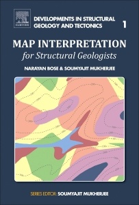
Map Interpretation for Structural Geologists covers various topics, from deciphering topography using contour patterns to interpreting folds, faults, unconformities and dykes. By interpreting several types of maps, this book gives readers the confidence to solve difficult geologic questions related to map interpretation in the classroom and in the field. Interpreting geological and structural maps is an inseparable part of learning structural geology in the undergraduate curriculum and postgraduate development.
1. Topography2. Horizontal- and inclined beds3. Maps with single “component4. Maps with multiple “components5. Map completion6. Miscellaneous
Soumyajit Mukherjee is a professor in the Department of Earth Sciences at the Indian Institute of Technology Bombay, India. He received his PhD in geology and MTech in applied geology from IIT Roorkee in 2007 and 2002, respectively, and received his BSc in geology from Presidency College (Kolkata) in 1999. He was a recipient of the Hutchison Young Scientist Award from IUGS in 2004. He served as the guest researcher at the Hans Ramberg Tectonic Lab, Uppsala University, from 2005 to 2006. Dr. Mukherjee, a structural geologist and tectonician, has performed fieldwork, microstructural studies, and analogue and analytical modeling, mainly on ductile shear kinematics and collisional tectonics. His research and editorial experience spans 15 years and so far he has authored and coedited 14 books and thematic volumes.
- Features approximately 30 full-color geological or structural maps and their solutions, from basic to the most complex
- Includes content appropriate for undergraduate and graduate students and professional geoscientists alike
- Presents a self-learning guide and teaching manual with minimum instruction required
Date de parution : 08-2017
Ouvrage de 142 p.
21.4x27.6 cm
Thème de Map Interpretation for Structural Geologists :
Mots-clés :
Angular unconformity; Axial plane; Bed attitude; Bore hole; Coal seam; Cross-section; Diastem; Event chronology; Fault; Fold axis; Inclined bed; Inter-limb angle; Map completion; Net slip calculation; Net-slip calculation; Nonplunging fold; Planar topography; Plunging fold; Spur; Stratum contour; Strike-line; Time gap; Topography; Tracing litho-contacts/fault planes in a map; Unconformity; Valley