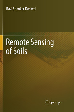
Remote Sensing of Soils, Softcover reprint of the original 1st ed. 2017
Auteur : Dwivedi Ravi Shankar

This book is about applications of remote sensing techniques in the studies on soils. In pursuance of the objective, the book initially provides an introduction to various elements and concepts of remote sensing, and associated technologies , namely Geographic Information System (GIS), Global Positioning System (GPS) in chapter-1. An overview of the sensors used to collect remote sensing data and important Earth observation missions is provided in chapter-2. The processing of satellite digital data (geometric and radiometric corrections, feature reduction, digital data fusion, image enhancements and analysis) is dealt with in Chapter-3. In the chapter to follow the interpretation of remote sensing data , very important and crucial step in d
eriving information on natural resources including soils resources, is discussed. An introduction to soils as a natural body with respect to their formation, physical and chemical properties used during inventory of soils, and soil classification is given in Chapter-5.The spectral response patterns of soils including hyperspectral characteristics -fundamental to deriving information on soils from spectral measurements, and the techniques of soil resources mapping are discussed in chapter-6 and -7,respectively. Furthermore, the creation of digital soil resources database and the development of soil information systems, a very important aspect of storage and dissemination of digital soil data to the end users are discussed in ch.apter-8. Lastly, the applications of remote sensing techniques in soil moisture estimation and soil fertility evaluation are covered in chapter-9 and -10, respectively.An introduction to remote sensing.- Earth observation systems.- Digital image processing.- Image interpretation.- An introduction to soils.- Spectral reflectance of soils.- Soil resource mapping.- Soil information systems.- Soil moisture estimation.- Soil fertility evaluation.
An update of geospatial technology including remote sensing
Illustrative examples of applications of remote sensing and GIS in soils, land degradation and watershed management
A comprehensive and step-by-step procedure for deriving information on soil resources using remote sensing data
Includes supplementary material: sn.pub/extras
Date de parution : 08-2018
Ouvrage de 500 p.
15.5x23.5 cm
Disponible chez l'éditeur (délai d'approvisionnement : 15 jours).
Prix indicatif 126,59 €
Ajouter au panierDate de parution : 09-2017
Ouvrage de 500 p.
15.5x23.5 cm
Disponible chez l'éditeur (délai d'approvisionnement : 15 jours).
Prix indicatif 179,34 €
Ajouter au panierThème de Remote Sensing of Soils :
Mots-clés :
land degradation; remote sensing; soil fertility; soil moisture; soils; watershed management


