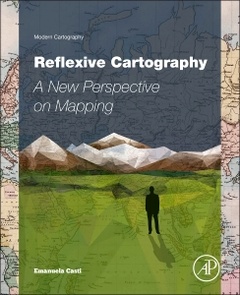
Reflexive Cartography A New Perspective in Mapping Modern Cartography Series
Auteur : Casti Emanuela
Directeur de Collection : Taylor D.R. Fraser

Reflexive Cartography addresses the adaptation of cartography, including its digital forms (GIS, WebGIS, PPGIS), to the changing needs of society, and outlines the experimental context aimed at mapping a topological space. Using rigorous scientific analysis based on statement consistency, relevance of the proposals, and model accessibility, it charts the transition from topographical maps created by state agencies to open mapping produced by citizens.
Adopting semiotic theory to uncover the complex communicative mechanisms of maps and to investigate their ability to produce their own messages and new perspectives, Reflexive Cartography outlines a shift in our way of conceptualizing maps: from a plastic metaphor of reality, as they are generally considered, to solid tools that play the role of agents, assisting citizens as they think and plan their own living place and make sense of the current world.
PART ONE 1. Cartographic interpretation between continuity and renewal: on the trail of chora2. The triumph of topos in colonial cartography: topographic metrics3. Landscape as a cartographic icon
PART TWO4. Technology in action: participatory cartographic systems5. Chorographic horizon: landscape cartography6. Coming full circle: towards a Chorography
Dr D. R. Fraser Taylor is Chancellor's Distinguished Research Professor and Director of the Geomatics and Cartographic Research Centre at Carleton University, Ottawa, Canada. He has been recognized as one of the world’s leading cartographers and a pioneer in the introduction of the use of the computer in cartography. He has served as the president of the International Cartographic Association from 1987 to 1995. Also, in 2008, he was elected a fellow of the Royal Society of Canada in recognition of his achievements. He was awarded the Carl Mannerfelt Gold Medal in August 2013. This highest award of the International Cartographic Association honours cartographers of outstanding merit who ha
- Applies a range of technologies to theoretical perspectives on mapping to innovatively map the world’s geographic diversity
- Features a multi-disciplinary perspective that weaves together geography, the geosciences, and the social sciences through territorial representation
- Authored and edited by two of the world’s foremost cartographic experts who combine more than 60 years of experience in research and in the classroom
- Presents more than 60 figures to underscore key concepts
Date de parution : 08-2015
Ouvrage de 288 p.
19x23.3 cm
Thème de Reflexive Cartography :
Mots-clés :
Anamorphosis; Cartesian logic; Cartographer�s and interpreter�s role; Cartographic paradigms; Cartographic semiosis; Cartography and art; Chorographic metrics; Chorography; Colonial cartography; Counter Mapping; Cristoforo Sorte; David Hockney; Environmental protection in Africa; Euclidean space; Geographic information technologies; GIS and WebGIS; Iconization; Landscape and map; Landscape and perspective; Landscape Cartography; Landscape logic; Mapping otherness; Maps and democratization practices; Maps and society; Maps and territory; Park of Arly; Participatory mapping systems; Participatory mapping; Perspective and semiotics of vision; Power of maps; Projections and Google Earth; Renaissance cartography; Rupestrian maps; Self-reference of maps; Semiotic analysis; Spatiality in the history of cartography; Spatiality of globalization; Spatialization and analogical system; Taxonomy; Topographic map; Topological space


