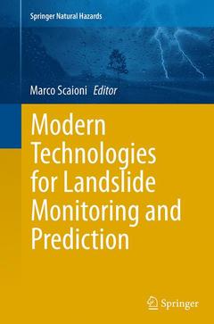
Modern Technologies for Landslide Monitoring and Prediction, Softcover reprint of the original 1st ed. 2015 Springer Natural Hazards Series
Coordonnateur : Scaioni Marco

Modern Technologies for Landslide Investigation and Prediction presents eleven contributed chapters from Chinese and Italian authors, as a follow-up of a bilateral workshop held in Shanghai on September 2013. Chapters are organized in three main parts: ground-based monitoring techniques (photogrammetry, terrestrial laser scanning, ground-based InSAR, infrared thermography, and GNSS networks), geophysical (passive seismic sensor networks) and geotechnical methods (SPH and SLIDE), and satellite remote-sensing techniques (InSAR and optical images). Authors of these contributes are internationally-recognized experts in their respective research fields.
Marco Scaioni works in the college of Surveying and Geo-Informatics at Tongji University, Shanghai (P.R. China). His research fields are mainly Close-range Photogrammetry, Terrestrial Laser Scanning, and other ground-based sensors for metrological and deformation monitoring applications to structural engineering and geosciences. In the period 2012-2016 he is chairman of the Working Group V/3 in the International Society for Photogrammetry and Remote Sensing, focusing on ?Terrestrial 3D Imaging and Sensors?.
Dr Marco Scaioni, male, born in 1969, graduated and achieved a PhD in Geodetic and Mapping Sciences at Politecnico di Milano, Italy. He is Professor the College of Surveying and Geo-Informatics at Tongji University in Shanghai, China. His main research interests are the application of close-range photogrammetry and laser scanning for deformation monitoring and geo-hazard management. He is Principal Investigation of the research area on “Remote Sensing and Sensor Network” at the Center for Spatial Information Science and Sustainable Development Applications at Tongji University. He has undertaken a series of research projects supported by Italian Ministry of Scientific Research and University, Ministry of Science and Technology of China, European Community, and several Italian administrations. His major current projects are focusing on spatial sensor networks for landslide monitoring/prediction and application of remote-sensing data to evaluate ice mass-balance in Antarctica. He is chairman of the ISPRS Working Group V/3 on Terrestrial 3D Imaging and Sensors (2012-2016). He is member of the Editorial board of Applied Geomatics (Springer) and the European Journal of Remote Sensing. He has published over 56 papers in peer-reviewed international journals and conferences.
Publication list
[1] Pozzoli A., Mussio L., Scaioni M., 2004. “A Project for the Survey of a Hydraulic Stream Confluence Model Based on a General Procedure for Three-Image Orientation.” Commemorative Volume for the 60th birthday of Prof. Dr. Armin Grün, Institute of Geodesy and Photogrammetry, ETH Zurich (Switzerland), pp. 201-208.
[2] Scaioni M., Guastamacchia E., Crimella E., 2009. “The Topographic Db as a tool for land management and government: the ‘Provincia di Lecco project’.” In: M. Caglioni, F. Scarlatti (eds.), Representation of Geographical Information for Planning, Ed. Esculapio, Bologna (Italy), pp. 29-38, ISBN 978-88-7488-316-5.
[3] Alba M., Caragliano S., Rota R.,
A book focusing on how research findings can be cast into practice of landslide study, monitoring, and prediction
Offers a quick overview of the state-of-the-art technologies in different fields: Geotechnics, Geophysics, Engineering Geology, Remote Sensing, and their integration
Includes a selection of invited papers from well-known authors in their respective research fields
Date de parution : 10-2016
Ouvrage de 249 p.
15.5x23.5 cm
Disponible chez l'éditeur (délai d'approvisionnement : 15 jours).
Prix indicatif 105,49 €
Ajouter au panierDate de parution : 02-2015
Ouvrage de 249 p.
15.5x23.5 cm
Disponible chez l'éditeur (délai d'approvisionnement : 15 jours).
Prix indicatif 105,49 €
Ajouter au panier


