Lavoisier S.A.S.
14 rue de Provigny
94236 Cachan cedex
FRANCE

Heures d'ouverture 08h30-12h30/13h30-17h30
Tél.: +33 (0)1 47 40 67 00
Fax: +33 (0)1 47 40 67 02


Url canonique : www.lavoisier.fr/livre/autre/matlab-recipes-for-earth-sciences-3rd-ed/trauth/descriptif_3270085
Url courte ou permalien : www.lavoisier.fr/livre/notice.asp?ouvrage=3270085

MATLAB® Recipes for Earth Sciences (3rd Ed., 3rd ed. 2010)
Langue : Anglais
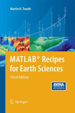
Couverture de l’ouvrage MATLAB® Recipes for Earth Sciences
MATLAB® is used for a wide range of applications in geosciences, such as image processing in remote sensing, the generation and processing of digital elevation models, and the analysis of time series. This book introduces methods of data analysis in geosciences using MATLAB, such as basic statistics for univariate, bivariate and multivariate datasets, jackknife and bootstrap resampling schemes, processing of digital elevation models, gridding and contouring, geostatistics and kriging, processing and georeferencing of satellite images, digitizing from the screen, linear and nonlinear time-series analysis, and the application of linear time-invariant and adaptive filters. The revised and updated Third Edition includes ten new sections and has greatly expanded on most chapters from the previous edition, including a step by step discussion of all methods before demonstrating the methods with MATLAB functions. New sections include: Data Storage and Handling, Data Structures and Classes of Objects, Generating M-Files to Regenerate Graphs, Publishing M-Files, Distribution Fitting, Nonlinear and Weighted Regression, Color-Intensity Transects of Varved Sediments, and Grain Size Analysis from Microscope Images. The text includes numerous examples demonstrating how MATLAB can be used on data sets from earth sciences. All MATLAB recipes can be easily modified in order to analyse the reader's own data sets.
Data Analysis in Earth Sciences.- to MATLAB.- Univariate Statistics.- Bivariate Statistics.- Time-Series Analysis.- Signal Processing.- Spatial Data.- Image Processing.- Multivariate Statistics.- Statistics on Directional Data.    

MATLAB® is used for a wide range of applications in geosciences, such as image processing in remote sensing, the generation and processing of digital elevation models, and the analysis of time series. This book introduces methods of data analysis in geosciences using MATLAB, such as basic statistics for univariate, bivariate and multivariate datasets, jackknife and bootstrap resampling schemes, processing of digital elevation models, gridding and contouring, geostatistics and kriging, processing and georeferencing of satellite images, digitizing from the screen, linear and nonlinear time-series analysis, and the application of linear time-invariant and adaptive filters. The revised and updated Third Edition includes ten new sections and has greatly expanded on most chapters from the previous edition, including a step by step discussion of all methods before demonstrating the methods with MATLAB functions. New sections include: Data Storage and Handling, Data Structures and Classes of Objects, Generating M-Files to Regenerate Graphs, Publishing M-Files, Distribution Fitting, Nonlinear and Weighted Regression, Color-Intensity Transects of Varved Sediments, and Grain Size Analysis from Microscope Images. The text includes numerous examples demonstrating how MATLAB can be used on data sets from earth sciences. All MATLAB recipes can be easily modified in order to analyse the reader's own data sets.

Contains 10 new sections and has greatly expanded on most chapters from the previous edition Contains exercises and fully worked-out solutions Many detailed illustrations Includes supplementary material: sn.pub/extras

Date de parution :

Ouvrage de 336 p.

15.5x23.5 cm

Disponible chez l'éditeur (délai d'approvisionnement : 15 jours).

63,25 €

Ajouter au panier

Date de parution :

Ouvrage de 336 p.

Disponible chez l'éditeur (délai d'approvisionnement : 15 jours).

Prix indicatif 63,25 €

Ajouter au panier