
Map Librarianship A Guide to Geoliteracy, Map and GIS Resources and Services Chandos Information Professional Series
Auteurs : Aber Susan Elizabeth Ward, Aber Jeremy
Map Librarianship identifies basic geoliteracy concepts and enhances reference and instruction skills by providing details on finding, downloading, delivering, and assessing maps, remotely sensed imagery, and other geospatial resources and services, primarily from trusted government sources. By offering descriptions of traditional maps, geographic information systems (GIS), remote sensing, and other geospatial technologies, the book provides a timely and practical guide for the map and geospatial librarian to blend confidence in traditional library skill sets.
Chapter 1: Introduction to Maps and Librarians
Chapter 2: Spatial Thinking and Geo-Literacy
Chapter 3: Basic Map Concepts—The Science of Cartography
Chapter 4: Geographic Information Systems and Remote Sensing
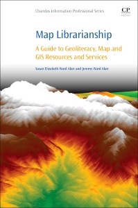
Chapter 5: Terrain Mapping Meets Digital Data
Chapter 6: Map and Geospatial Librarianship
Chapter 7: Geospatial Resources and Instruction Services
Chapter 8: Reference Desk
Chapter 9: Collection Development
Chapter 10: Cataloging and Classifying
Chapter 11: Promotion and Summary of Map and GIS Resources and Services
Dr. Jeremy W. Aber is an assistant professor of Geography at Middle Tennessee State University. He teaches GIS and elements of remote sensing and cartography at both the undergraduate and graduate levels involving the theory and applied practice of GIS, along with aesthetic components related to the cartographic process. With a B.F.A. in art and both M.A. and PhD in Geography, he has done work in the areas of GIS, cartography, geographic visualization techniques, small-format aerial photography, virtual geographies and video games, cognitive geography, and sense of place and place attachment.
- Includes rarely discussed concepts of citing and referencing maps and geospatial data, fair use and copyright
- Creates an awareness and appreciation of existing print map collections, while building digital stewardship with surrogate map and aerial imagery collections
- Provides an introduction to the theory and applications of GIS, remote sensing, participatory neogeography and neocartography practices, and other geospatial technologies
- Includes a list of geospatial resources with descriptions and illustrations of commonly used map types and formats, online geospatial data sources, and an introduction to the most commonly used geospatial software packages available, on both desktop and mobile platforms
Date de parution : 11-2016
Ouvrage de 294 p.
15x22.8 cm