Lavoisier S.A.S.
14 rue de Provigny
94236 Cachan cedex
FRANCE

Heures d'ouverture 08h30-12h30/13h30-17h30
Tél.: +33 (0)1 47 40 67 00
Fax: +33 (0)1 47 40 67 02


Url canonique : www.lavoisier.fr/livre/autre/earth-science-satellite-remote-sensing/qu/descriptif_3271570
Url courte ou permalien : www.lavoisier.fr/livre/notice.asp?ouvrage=3271570

Earth Science Satellite Remote Sensing, 2006 Vol.2: Data, Computational Processing, and Tools

Langue : Anglais

Coordonnateurs : Qu John J., Gao Wei, Kafatos Menas, Murphy Robert E., Salomonson Vincent V.
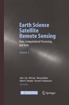
Couverture de l’ouvrage Earth Science Satellite Remote Sensing

This book provides information on the Earth science remote sensing data information and data format such as HDF-EOS. It evaluates the current data processing approaches and introduces data searching and ordering from different public domains. It further explores the remote sensing and GIS migration products and WebGIS applications. Both volumes are designed to give an introduction to current and future NASA, NOAA and other Earth science remote sensing.

Chapter 1: Introduction to Earth Science Satellite Remote Sensing Data Chapter 2: Introduction to Remote Sensing Data and Services at GES DAAC Chapter 3: Introduction Remote Sensing Data at EDC Chapter 4: Data Searching and Ordering from EOS Data Gateway(EDG) Chapter 5: MODIS Data Searching and Ordering from GDAAC Chapter 6: MODIS Calibration and Characterization (3.59Mb) Chapter 7: MODIS Simple and Scalable Script based Science Processor (S4P) Chapter 8: MODIS and GIS Migration Products via GDAAC RSIP Chapter 9: Remote Sensing Data Mining Chapter 10: EOS Tools Overview Chapter 11: ECS Data Pools Chapter 12: Introduction to HDF-EOS Chapter 13: MODIS Reprojection Tool (MRT) Chapter 14: Introduction to HDF-EOS Data Format Converter Chapter 15: Introduction to HDF-Look (new version of Msphinx) Chapter 16: Interoperable Access and Services of EOS Data Based on OGC Protocols Chapter 17: Distributed Online Data Access and Analysis Chapter 18; NASA WebGIS System (NWGISS) Chapter 19: Introduction to Distributed GIS Chapter 20: WebGIS at GDAAC

Provides information on the Earth science remote sensing data information and data format such as HDF-EOS, and tools

Evaluates the current data processing approaches

Introduces data searching and ordering from different public domains

Explores the remote sensing and GIS migration products and WebGIS applications

Quality full color illustrations

Date de parution :

Ouvrage de 335 p.

15.5x23.5 cm

Disponible chez l'éditeur (délai d'approvisionnement : 15 jours).

Prix indicatif 210,99 €

Ajouter au panier

Date de parution :

Ouvrage de 335 p.

15.5x23.5 cm

Sous réserve de disponibilité chez l'éditeur.

Prix indicatif 210,99 €

Ajouter au panier