Lavoisier S.A.S.
14 rue de Provigny
94236 Cachan cedex
FRANCE

Heures d'ouverture 08h30-12h30/13h30-17h30
Tél.: +33 (0)1 47 40 67 00
Fax: +33 (0)1 47 40 67 02


Url canonique : www.lavoisier.fr/livre/autre/coastal-et-marine-geospatial-technologies-coastal-systems-et-continental-margins-vol-13/green/descriptif_1782557
Url courte ou permalien : www.lavoisier.fr/livre/notice.asp?ouvrage=1782557

Coastal and Marine Geospatial Technologies, 2010 Coastal Systems and Continental Margins Series, Vol. 13

Langue : Anglais

Coordonnateur : Green D.R.

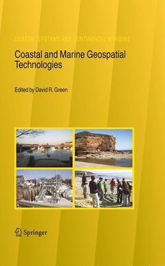
Couverture de l’ouvrage Coastal and Marine Geospatial Technologies
In 2005 the CoastGIS symposium and exhibition was once again held in Aberdeen, Scotland, in the UK, the second time that we have had the privilege host this international event in the city of Aberdeen. This was the 6th International S- posium Computer Mapping and GIS for Coastal Zone Management, a collabo- tion between the International Cartographic Association?s (ICA) Commission on Marine Cartography, and the International Geographical Union?s (IGU) Comm- sion on Coastal Systems. The theme for 2005 was: De ning and Building a Marine and Coastal Spatial Data Infrastructure. As a major coastal event, the CoastGIS series of conferences always attracts an international audience of coastal researchers, managers, and pr- titioners who use one or more of the geospatial technologies (e. g. GIS, GPS, digital mapping, remote sensing, databases, and the Internet) in their work. The CoastGIS series is fundamentally an international event which over the years has gained a strong following attracting delegates from around the globe. Hosted by the University of Aberdeen ? at the Aberdeen Exhibition and Conference Centre (AECC) ? once again CoastGIS 2005 provided an opportunity to communicate the results of a wide range of innovative scienti c research into coastal and marine applications of the geospatial technologies, including remote sensing, Geograp- cal Information Systems (GIS), Global Positioning Systems (GPS), databases, data models, the Internet and online mapping systems.
Preface Part I. Information Networks, SDI and Information Systems A Metadata Service for Managing Spatial Resources of Coastal Areas The Development of an Australian Marine Spatial Information System (AMSIS) to Support Australian Government Ocean Policy and Multi-Use Marine Activities Spatial Data Infrastructure in the Management of the Lagos Lagoon Harmonising Marine Information Exchange in Ireland Creating Marine Spatial Data Infrastructure for the UK Unlocking the Marine Data Treasure Chest The European Marie Curie Project 'ECO-IMAGINE' Coastal Ocean Information Network (ATLANTIC) - From Concept to Reality: A Status Report A National Database on Coastal Dunes: Emilia-Romagna and Southern Veneto Littorals (Italy) Establishment of Marine and Coastal Spatial Data Infrastructure in Indonesia Part II. GIS Tools Prestige Marine Pollution: A GIS Tool Aquaculture in Sicily: Ecological and Economic Aspects Soft Copy Photogrammetry to Measure Shore Platform Erosion on Decadal Time Scales Regionalizing Coastal Zones with Geospatial Tools for Integrated Coastal Zone Management Applying Geospatial Technologies to WEEDMAT monitoring and mapping: The Ythan Estuary, NE Scotland 'Ythanview' – Visualizing an Estuary and Virtual Fieldwork at the Ythan Estuary, Scotland, UK Analysis of Long-Term Changes of a Sandy Shoreline Utilising High-Resolution Aerial Photography GIS in the Trilateral Monitoring and Assessment Program (TMAP) Integrating GIS with Hydrodynamic Model for Wastewater Disposal and Management: Pearl River Estuary Geographic Information Systems and Sustainable Water ResourcesManagement in Nigeria Spatial Analysis of Traffic and Risks in the Coastal Zone Part III. Spatial Planning Predictive Models to Inform Spatial Planning for Scottish Marine Fish Farms Towards a GIS-Based Methodology for Marine Protected Area Zoning Functional Connected Areas in Regional Planning: Sea and Land Uses Interaction The Development of Coastal Information Systems: The Role of Networks in Bringing Spatial Analysis into Planning and Management Part IV. Coastal Geomorphology GIS Tool for Coastal Morphodynamics Analysis Paros Island (Cyclades, Aegean Sea), Coastal Zone: Natural Processes and Dynamics Palaeogeographic Evolution of the Cyclades Islands (Greece) During the Holocene Structural Control of Geomorphological Evolution of Meganissi Island (Ionian Sea) Coastal Zone and Natural Hazard Risk Detection Based on Fuzzy Sets A Simple and Efficient Methodology to Assess Long-Term Shoreline Evolution - Case Study Study of Human Induced Recent Geomorphological and Land Use Changes of the Acheloos Delta Area in Western Greece Using GIS Part V. The Coastal Environment Multi-Functional Assessment of Coastal Landscape with Climate Change A GIS for Managing Past Knowledge in Coastal Defence Planning Part VI. Coastal Hazards and Vulnerability Environmental Indicators GIS of the Catalonian Coast Geohazards and Geographic Information in the Coast of Tarragona (Spain) Assessing the Vulnerability of Asian Megadeltas to Climate Change Using GIS Color Plates Index

Geospatial technologies

Coastal and marine environments

Coastal researcher and practitioner

Date de parution :

Ouvrage de 451 p.

15.5x23.5 cm

Disponible chez l'éditeur (délai d'approvisionnement : 15 jours).

Prix indicatif 158,24 €

Ajouter au panier

Date de parution :

Ouvrage de 451 p.

15.5x23.5 cm

Sous réserve de disponibilité chez l'éditeur.

Prix indicatif 158,24 €

Ajouter au panier