Advanced Geoinformation Science
Coordonnateurs : Yang Chaowei, Wong David, Miao Qianjun, Yang Ruixin
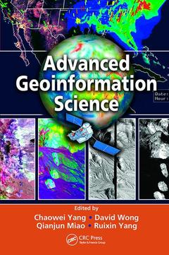
Many of the challenges of the next century will have physical dimensions, such as tsunamis, hurricanes, and climate change as well as human dimensions such as economic crises, epidemics, and emergency responses. With pioneering editors and expert contributors, Advanced Geoinformation Science explores how certain technical aspects of geoinformation have been used and could be used to address such global issues. The editors and chapter authors have been involved in global initiatives such as Global Earth Observation System of Systems (GEOSS) and Digital Earth, and research problems such as air quality, public health, and cloud computing.
The book delineates the problems communities are likely to face and how advanced geoinformation science can be a part of their solution. It introduces different methods in collecting spatial data as the initial feeds to geoinformation science and computing platforms. It discusses systems for data management, data integration and analysis, the geoinformation infrastructure, as well as knowledge capture, formatting, and utilization. The book then explores a variety of geoinformation applications, highlighting environmental, agriculture, and urban planning uses.
Geoinformation science encompasses more than just traditional technologies such as Remote Sensing, GIS, GPS, and supporting disciplines. And although the science continues to become more multidisciplinary, the literature remains compartmentalized according to the traditional disciplinary boundaries. Capturing recent developments in geoinformation science and linking IT with a wide range of Earth sciences, the authors explain how advanced technology and concepts play a significant role in recent advancements. Enhanced with forty-four color illustrations, live examples such as GOS and AirNow, and insights from NASA, EPA, and USGS, the book provides a vision for the future and explores how to bring that vision into reality.
Advanced GeoInformation Science: An Overview. Space-based Earth Observation (EO). Ground-based EO and Sensor Webs. GeoInformation Computing Platform. Data Access and Data Systems. Geospatial Data Analysis and Information. Information Infrastructure. Geospatial Knowledge Management and Processing. Environmental Applications. Decision Support and Education Applications. Visions for Advanced GeoInformation Science.
Date de parution : 09-2017
15.6x23.4 cm
Disponible chez l'éditeur (délai d'approvisionnement : 14 jours).
Prix indicatif 93,24 €
Ajouter au panierDate de parution : 10-2010
Ouvrage de 608 p.
15.6x23.4 cm
Thèmes d’Advanced Geoinformation Science :
Mots-clés :
Spatial Data; SWP; Earth Observations; Spatial Data Mining; Geoinformation Infrastructure; Geospatial Web Services; Data Access and Data Systems; Geoinformation Science; Spatial Data Analysis; Data Set; OGC Web Service; GES Disc; ES Data; SOA; Rain Rate; GIS Application; HSI Data; Urban Heat Islands; Digital Earth; 50W 40W 30W 20W 10W; II; Ice Chart; Airborne SAR; Cloud Computing; Capture Spatial Data; Sea Ice Data; Digital Earth Vision; Web Services; Atmospheric Remote Sensing