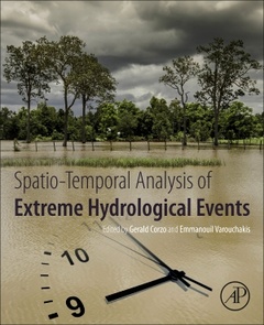
Spatiotemporal Analysis of Extreme Hydrological Events
Coordonnateurs : Corzo Gerald, Varouchakis Emmanouil

Spatio-temporal Analysis of Extreme Hydrological Events offers an extensive view of the experiences and applications of the latest developments and methodologies for analyzing and understanding extreme environmental and hydrological events. The book addresses the topic using spatio-temporal methods, such as space-time geostatistics, machine learning, statistical theory, hydrological modelling, neural network and evolutionary algorithms. This important resource for both hydrologists and statisticians interested in the framework of spatial and temporal analysis of hydrological events will provide users with an enhanced understanding of the relationship between magnitude, dynamics and the probability of extreme hydrological events.
1. Geostatistics: Mathematical and Statistical Basis. 2. Background of spatiotemporal geostatistical analysis: Application to aquifer level mapping
3. Large-scale exploratory analysis of the spatio-temporal distribution of climate projections: Applying STRIVIng toolbox 4. Spatio-temporal drought analysis at country scale through the application of the STAND toolbox 5. Spatiotemporal analysis of extreme rainfall events using object based approach 6. Spatial and temporal variations of Habitat Suitability for fish; A case study in Abras de Mantequilla wetland, Ecuador 7. A comparison on spatial – temporal scale between multiscalar drought indices in the South Central Region of Vietnam
Main audience: Hydrologists, scientists working on water resource management, Aquatic Scientist, Climatologists.
Secondary audience: statisticians interested in the framework of spatial and temporal analysis of hydrological events, water resource engineers, coastal and estuarine scientists, applied mathematicians.
Dr. Emmanouil Varouchakis is an Instructor/Researcher at the School of Environmental Engineering, Technical University of Crete, Greece. He holds a PhD in Geo-technology and the Environment-Spatiotemporal Geostatistics from the Technical University of Crete. Since 2013 he teaches the courses ‘’Introduction to Geostatistics’’, ‘’Applied Geostatistics’’ and ‘’Environmental Risk Analysis’’ at the Schools of Environmental and Mineral Resources Engineering. He has published several research articles in international journals and he has presented his research findings in international conferences. In 2015 he has been awarded the Natural Resources Research grant award by the International Association of Mathematical Geosciences for his research work entitled ‘’A Bayesian space-time geostatistical model for groundwater level variability estimation’’.
- Presents spatio-temporal processes, including multivariate dynamic modelling
- Provides varying methodological approaches, giving the readers multiple hydrological modelling information to use in their work
- Includes a variety of case studies making the context of the book relatable to everyday working situations
Date de parution : 11-2018
Ouvrage de 192 p.
19x23.3 cm
Thèmes de Spatiotemporal Analysis of Extreme Hydrological Events :
Mots-clés :
Climate change; Connected-component labeling algorithm; DDRASTIC; Depth; Deterministic methods; Extreme rainfall events; Fish; Geostatistics; Global models analysis; Groundwater; Habitat; Interpolation; Kriging; Multidimensional rainfall analysis; NCDA; Non-Contiguous Drought Area (NCDA)Spatial–temporal drought characteristics; Nonlinear transformation; Nonseparable variograms; Precipitation and temperature projections; Rainfall object-based methods; Satellite-based rainfall products; Separable variograms; South Central Region of Vietnam; Space–time kriging; Spatiotemporal analysis; Spatiotemporal drought analysis; Spatiotemporal interpolation; Spatiotemporal; SPEI; SPI; STAND toolbox; STRIVIng toolbox; Temporal and spatial variability; Tropical; Variogram; Velocity; Wetland


